- Handmade locally. No import duty or tax
- FREE worldwide delivery
- 90-day returns & 5-year product guarantee
- Questions? WhatsApp me any time
Own a piece of history
7,000+ 5 star reviews


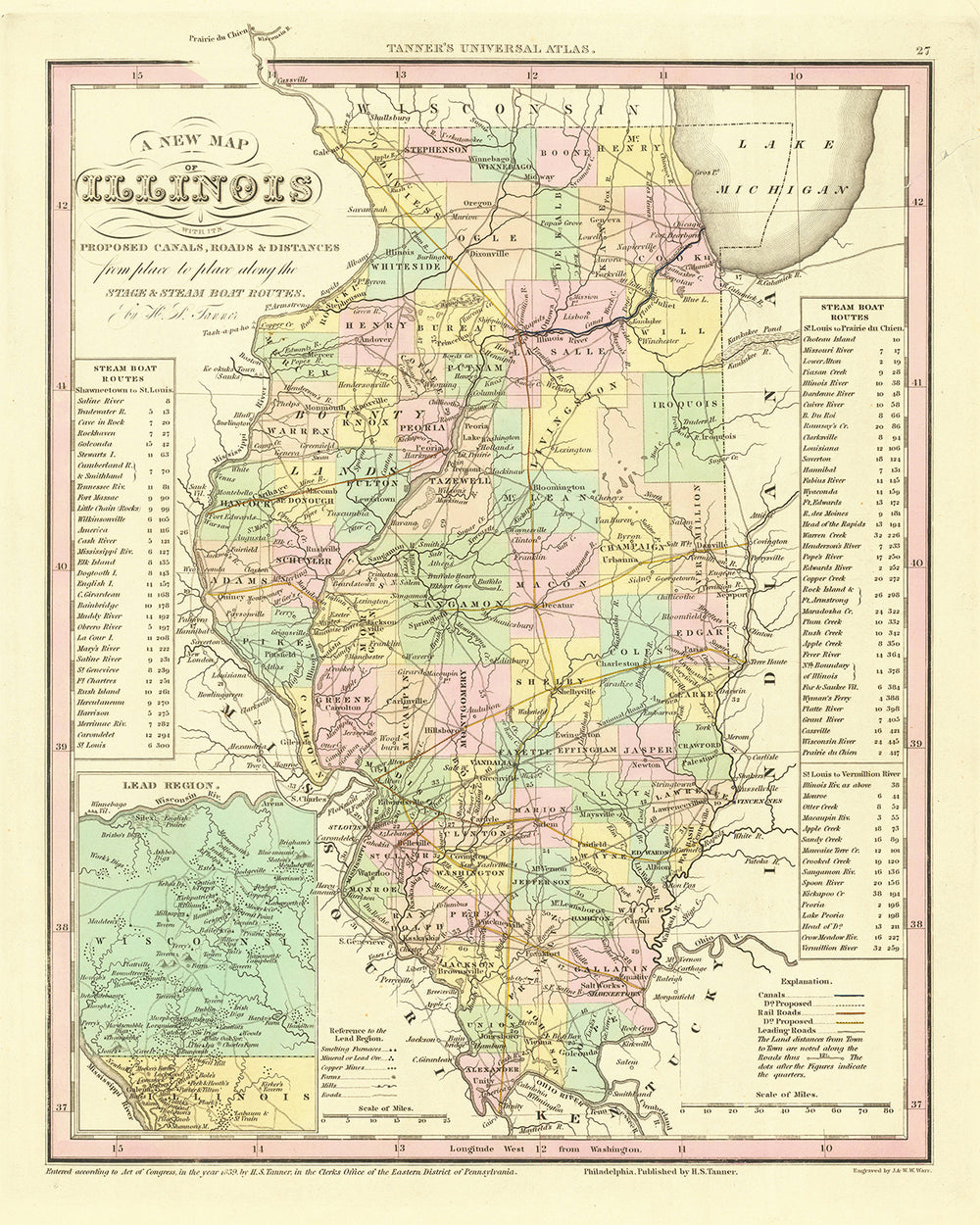
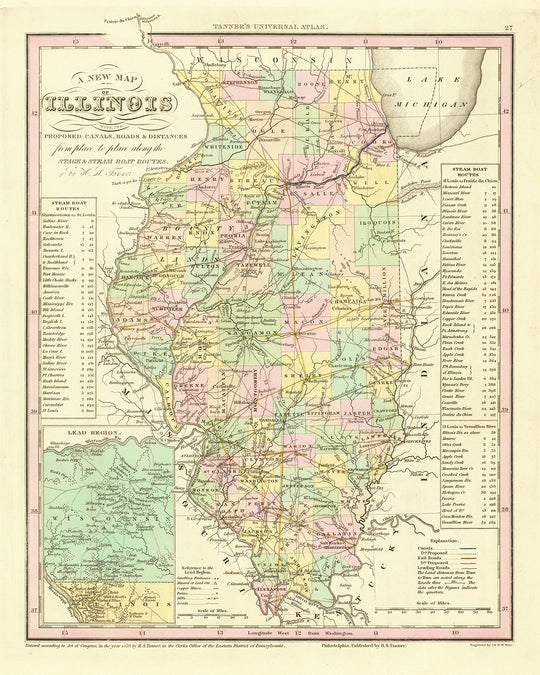
Immerse yourself in the allure of historical Illinois with this exquisite Old Map of Illinois, carefully crafted by the esteemed cartographer Henry Schenck Tanner in 1836. This beautifully preserved map, which includes intricate details of canals, roads, railroads, and travel distances, offers a window into a pivotal era of Illinois' development. As an invaluable testament to the state's early beginnings, the map allows for a thorough exploration of Illinois during a time of profound growth and transformation.
Every carefully inscribed line and notation on the map reflects an emerging network of settlements, burgeoning travel routes, and evolving territories that would shape the future of Illinois. This fascinating snapshot of history encapsulates the era's sense of exploration and determination, making this map a priceless treasure for those with an affinity for history and cartography.
Settlements and Points of Interest:
- Chicago (1833): Now the largest city in Illinois, it began as a small settlement and quickly rose to prominence due to its strategic location on Lake Michigan.
- Aurora (1834): Nicknamed the "City of Lights," Aurora was one of the first cities in the country to adopt all-electric street lights.
- Rockford (1834): Known for its cultural and historical institutions, including the Mendelssohn Performing Arts Center and the Tinker Swiss Cottage.
- Joliet (1834): With its diverse architectural landscape, Joliet is a living testament to the state's rich architectural history.
- Naperville (1831): Celebrated for the Naper Settlement, an outdoor history museum that tells the story of Naperville's past.
- Springfield (1819): The state capital of Illinois, Springfield is renowned for being the home of Abraham Lincoln and a host of historical landmarks associated with him.
- Peoria (1691): As one of the oldest settlements in Illinois, Peoria has played a significant role in the state's development and is a historical gem on the Illinois River.
- Alton (1818): Known for its involvement in the abolitionist movement and as the site of the final Lincoln-Douglas debate.
- Belleville (1814): Belleville boasts the second oldest philharmonic orchestra in the country and a plethora of 19th-century architecture.
- Cahokia (1699): Home to the historic Cahokia Courthouse, which played a significant role in the region's development.
- Canton (1825): The site of notable historical events, including the devastating Parlin-Ingersoll Library fire.
- Carrollton (1821): A quaint city that serves as the county seat of Greene County.
- Danville (1827): Home to a number of nationally registered historic places and a rich coal mining history.
- Edwardsville (1818): The third oldest city in Illinois, and home to Southern Illinois University Edwardsville.
- Galena (1826): Known for its well-preserved 19th-century buildings and the Ulysses S. Grant home.
- Hillsboro (1823): Notably where Abraham Lincoln made his first political speech.
- Jacksonville (1825): Home to Illinois College, the oldest college in Illinois to grant a degree.
- Kaskaskia (1703): Once the capital of Illinois and significant as an early French settlement.
- Lewistown (1822): Known for the Rasmussen Blacksmith Shop Museum and the Lewistown Trail.
- Nauvoo (1834): An important site in the history of the Latter Day Saint movement.
- Palestine (1811): Home to the historic Fife Opera House and known for its annual Pioneer City Days.
- Pittsfield (1833): Famous for the Pike County Courthouse, where Abraham Lincoln practiced law.
- Quincy (1822): The site of the sixth Lincoln-Douglas debate, with many preserved historic landmarks.
- Shawneetown (1748): Known for the historic Old Shawneetown Bank, the first bank chartered in Illinois.
- Vandalia (1819): The second state capital of Illinois and home to the Vandalia State House State Historic Site.
- Warsaw (1834): Site of the Battle of Warsaw during the Mormon War.
- Waterloo (1818): Known for its historic Main Street and the Monroe County Courthouse.
- Albion (1818): Established by a group of English settlers, it's the county seat of Edwards County.
- Rushville (1825): Home to the Schuyler Jail Museum, which is listed on the National Register of Historic Places.
- Pinckneyville (1830): Known for the Pinckneyville Mardi Gras, the oldest Mardi Gras celebration in the Midwest.
Historical Events:
- The Winnebago War (1827): This conflict occurred in northern Illinois, and the map shows the lands affected by the war.
- The Black Hawk War (1832): This significant event in Illinois' history marks the end of Native American armed resistance to U.S. expansion in the area.
Notable Geographic and Cultural Features:
- The Mississippi River: This prominent river serves as a major boundary and was a critical transportation route at the time of the map's creation.
- The Illinois River: Another important waterway that is still an active route for trade and transportation.
- The Wabash River: Forming the southeastern boundary of the state, this river was vital for commerce and travel.
- The Galena River: Important for the lead-mining industry of Galena during the map's creation.
- The Cahokia Mounds: One of the most important archaeological sites in North America, representing the remains of a pre-Columbian Native American city.
This Old Map of Illinois by H. S. Tanner, 1836, is more than just a historic artifact—it's a captivating narrative of Illinois' past, told through the lens of cartography. Whether you're a history enthusiast, a cartography connoisseur, or simply a lover of beautiful and meaningful artifacts, this map is a timeless treasure to be admired, studied, and enjoyed.
Please double check the images to make sure that a specific town or place is shown on this map. You can also get in touch and ask us to check the map for you.
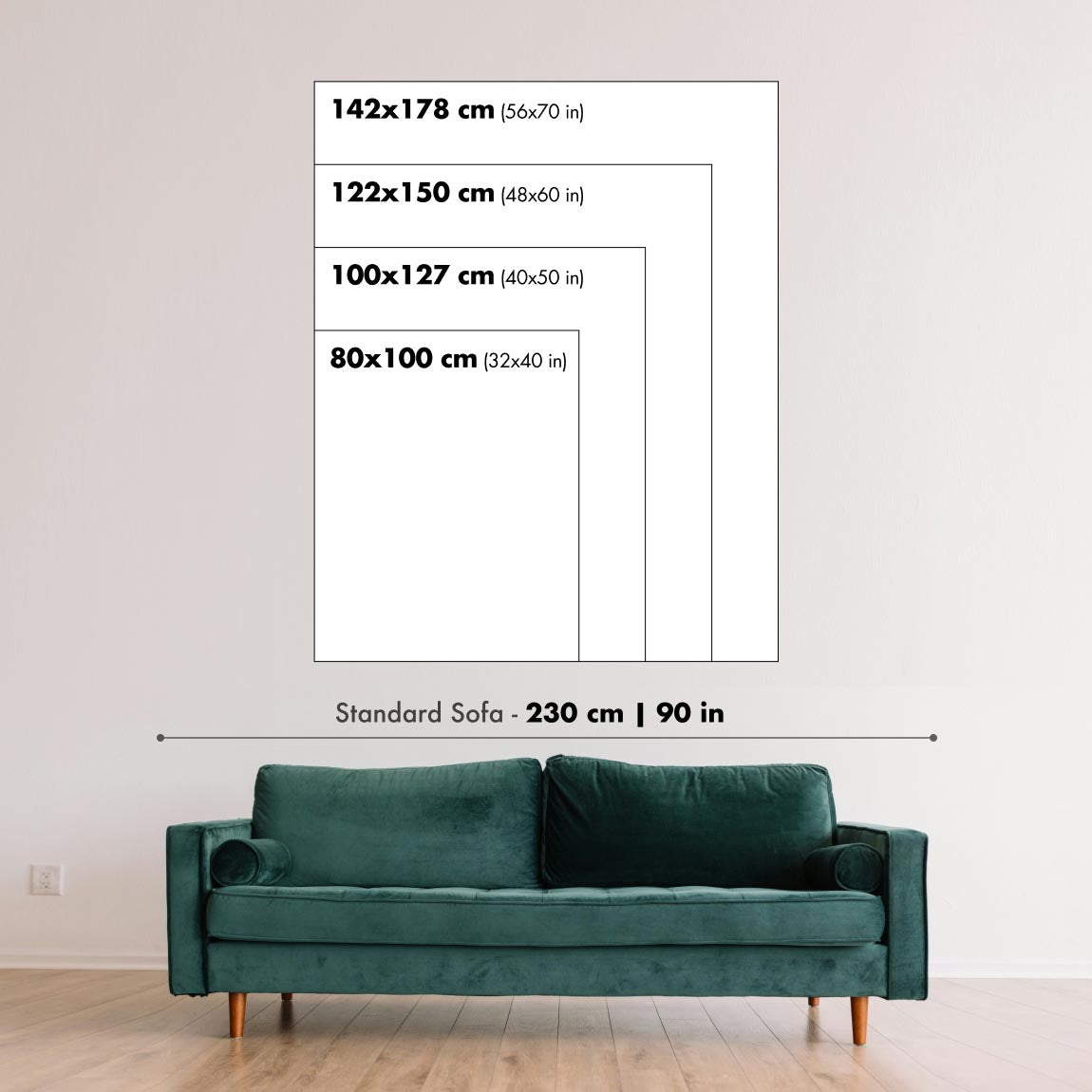
This map looks great at all sizes: 12x16in (30.5x41cm), 16x20in (40.5x51cm), 18x24in (45.5x61cm), 24x30in (61x76cm), 32x40in (81.5x102cm), 40x50in (102x127cm), 48x60in (122x153cm) and 56x70in (142x178cm), but it looks even better when printed large.
I can create beautiful, large prints of this map up to 100in (254cm). Please get in touch if you're looking for larger, customised or different framing options.
The model in the listing images is holding the 18x24in (45.5x61cm) version of this map.
The fifth listing image shows an example of my map personalisation service.
If you’re looking for something slightly different, check out my main collection of USA and North America maps.
Please contact me to check if a certain location, landmark or feature is shown on this map.
This would make a wonderful birthday, Christmas, Father's Day, work leaving, anniversary or housewarming gift for someone from the areas covered by this map.
This map is available as a giclée print on acid free archival matte paper, or you can buy it framed. The frame is a nice, simple black frame that suits most aesthetics. Please get in touch if you'd like a different frame colour or material. My frames are glazed with super-clear museum-grade acrylic (perspex/acrylite), which is significantly less reflective than glass, safer, and will always arrive in perfect condition.
This map is also available as a float framed canvas, sometimes known as a shadow gap framed canvas or canvas floater. The map is printed on artist's cotton canvas and then stretched over a handmade box frame. We then "float" the canvas inside a wooden frame, which is available in a range of colours (black, dark brown, oak, antique gold and white). This is a wonderful way to present a map without glazing in front. See some examples of float framed canvas maps and explore the differences between my different finishes.
For something truly unique, this map is also available in "Unique 3D", our trademarked process that dramatically transforms the map so that it has a wonderful sense of depth. We combine the original map with detailed topography and elevation data, so that mountains and the terrain really "pop". For more info and examples of 3D maps, check my Unique 3D page.
For most orders, delivery time is about 3 working days. Personalised and customised products take longer, as I have to do the personalisation and send it to you for approval, which usually takes 1 or 2 days.
Please note that very large framed orders usually take longer to make and deliver.
If you need your order to arrive by a certain date, please contact me before you order so that we can find the best way of making sure you get your order in time.
I print and frame maps and artwork in 23 countries around the world. This means your order will be made locally, which cuts down on delivery time and ensures that it won't be damaged during delivery. You'll never pay customs or import duty, and we'll put less CO2 into the air.
All of my maps and art prints are well packaged and sent in a rugged tube if unframed, or surrounded by foam if framed.
I try to send out all orders within 1 or 2 days of receiving your order, though some products (like face masks, mugs and tote bags) can take longer to make.
If you select Express Delivery at checkout your order we will prioritise your order and send it out by 1-day courier (Fedex, DHL, UPS, Parcelforce).
Next Day delivery is also available in some countries (US, UK, Singapore, UAE) but please try to order early in the day so that we can get it sent out on time.
My standard frame is a gallery style black ash hardwood frame. It is simple and quite modern looking. My standard frame is around 20mm (0.8in) wide.
I use super-clear acrylic (perspex/acrylite) for the frame glass. It's lighter and safer than glass - and it looks better, as the reflectivity is lower.
Six standard frame colours are available for free (black, dark brown, dark grey, oak, white and antique gold). Custom framing and mounting/matting is available if you're looking for something else.
Most maps, art and illustrations are also available as a framed canvas. We use matte (not shiny) cotton canvas, stretch it over a sustainably sourced box wood frame, and then 'float' the piece within a wood frame. The end result is quite beautiful, and there's no glazing to get in the way.
All frames are provided "ready to hang", with either a string or brackets on the back. Very large frames will have heavy duty hanging plates and/or a mounting baton. If you have any questions, please get in touch.
See some examples of my framed maps and framed canvas maps.
Alternatively, I can also supply old maps and artwork on canvas, foam board, cotton rag and other materials.
If you want to frame your map or artwork yourself, please read my size guide first.
My maps are extremely high quality reproductions of original maps.
I source original, rare maps from libraries, auction houses and private collections around the world, restore them at my London workshop, and then use specialist giclée inks and printers to create beautiful maps that look even better than the original.
My maps are printed on acid-free archival matte (not glossy) paper that feels very high quality and almost like card. In technical terms the paper weight/thickness is 10mil/200gsm. It's perfect for framing.
I print with Epson ultrachrome giclée UV fade resistant pigment inks - some of the best inks you can find.
I can also make maps on canvas, cotton rag and other exotic materials.
Learn more about The Unique Maps Co.
Map personalisation
If you're looking for the perfect anniversary or housewarming gift, I can personalise your map to make it truly unique. For example, I can add a short message, or highlight an important location, or add your family's coat of arms.
The options are almost infinite. Please see my map personalisation page for some wonderful examples of what's possible.
To order a personalised map, select "personalise your map" before adding it to your basket.
Get in touch if you're looking for more complex customisations and personalisations.
Map ageing
I have been asked hundreds of times over the years by customers if they could buy a map that looks even older.
Well, now you can, by selecting Aged before you add a map to your basket.
All the product photos you see on this page show the map in its Original form. This is what the map looks like today.
If you select Aged, I will age your map by hand, using a special and unique process developed through years of studying old maps, talking to researchers to understand the chemistry of aging paper, and of course... lots of practice!
If you're unsure, stick to the Original colour of the map. If you want something a bit darker and older looking, go for Aged.
If you are not happy with your order for any reason, contact me and I'll get it fixed ASAP, free of charge. Please see my returns and refund policy for more information.
I am very confident you will like your restored map or art print. I have been doing this since 1984. I'm a 5-star Etsy seller. I have sold tens of thousands of maps and art prints and have over 5,000 real 5-star reviews. My work has been featured in interior design magazines, on the BBC, and on the walls of dozens of 5-star hotels.
I use a unique process to restore maps and artwork that is massively time consuming and labour intensive. Hunting down the original maps and illustrations can take months. I use state of the art and eye-wateringly expensive technology to scan and restore them. As a result, I guarantee my maps and art prints are a cut above the rest. I stand by my products and will always make sure you're 100% happy with what you receive.
Almost all of my maps and art prints look amazing at large sizes (200cm, 6.5ft+) and I can frame and deliver them to you as well, via special oversized courier. Contact me to discuss your specific needs.
Or try searching for something!


