













Rare Old Map of Atlanta, Georgia by USGS, 1954: East Point, Hapeville & College Park
In unserer Londoner Werkstatt aus der Originalkarte von 1957 restauriert und in Museumsqualität gedruckt. Vollständige Beschreibung
Das Sammlerangebot
Wählen Sie zwei berechtigte Werke und erhalten Sie auf beide 20 % Rabatt. Wählen Sie drei, und das günstigste ist kostenlos – eine maximale Ersparnis von 33 %.
Kombinieren Sie berechtigte Standardkarten und Kunstdrucke nach Belieben. Kein Code erforderlich; das Angebot wird an der Kasse automatisch angewendet.
Standardmäßige Konfigurationen nach Maßanfertigung sind inbegriffen. Maßgeschneiderte Größen, personalisierte Entwürfe und Auftragsarbeiten sind ausgeschlossen.
Benötigen Sie die Lieferung an unterschiedliche Adressen? Kontaktieren Sie uns vor der Bestellung.Das Sammlerangebot
Wählen Sie zwei berechtigte Werke und erhalten Sie auf beide 20 % Rabatt. Wählen Sie drei, und das günstigste ist kostenlos – eine maximale Ersparnis von 33 %.
Kombinieren Sie berechtigte Standardkarten und Kunstdrucke nach Belieben. Kein Code erforderlich; das Angebot wird an der Kasse automatisch angewendet.
Standardmäßige Konfigurationen nach Maßanfertigung sind inbegriffen. Maßgeschneiderte Größen, personalisierte Entwürfe und Auftragsarbeiten sind ausgeschlossen.
Benötigen Sie die Lieferung an unterschiedliche Adressen? Kontaktieren Sie uns vor der Bestellung. In London restauriert • Gedruckt und gerahmt in the UK
Aus der Originalkarte von 1957 restauriert und in Museumsqualität gedruckt. Vollständige Beschreibung
Größe wählen
Ausführung wählen


(Mehr Infos)
Geschenkmitteilung & individuelle Ausführung

Wenn Sie eine Geschenkmitteilung oder eine Ausführung (Puzzle, Aluminiumplatte usw.) hinzufügen möchten, die hier nicht verfügbar ist, geben Sie dies bitte in der "Bestellnotiz" beim Checkout an.
Jede Bestellung wird individuell angefertigt. Wenn Sie die Größe leicht anpassen oder auf einem ungewöhnlichen Material drucken lassen möchten, lassen Sie es uns einfach wissen. Wir haben im Laufe der Jahre Tausende von individuellen Bestellungen bearbeitet, daher gibt es (fast) nichts, was wir nicht bewältigen können.
Sie können uns auch kontaktieren, bevor Sie bestellen, wenn Sie möchten!
Ein Stück Geschichte für Ihr Zuhause
Über 8.000 5-Sterne-Bewertungen

Published in 1957 using survey data gathered in 1954, “East Point” is a revealing U.S. Geological Survey portrait of Atlanta’s southwestern approaches...
WeiterlesenPublished in 1957 using survey data gathered in 1954, “East Point” is a revealing U.S. Geological Survey portrait of Atlanta’s southwestern approaches at a pivotal mid-century moment. At a 1:24,000 scale, the map captures Atlanta, East Point, Hapeville, College Park, Fort McPherson, and the road and rail corridors that tied them together before the full force of postwar metropolitan expansion reshaped the region. Its original title is elegantly understated, yet the sheet encompasses a complex urban landscape: established neighborhoods, military grounds, industrial arteries, airport facilities, and rolling Georgia terrain. As a historical document, it preserves the texture of a city in transition, showing Atlanta not as the sprawling metropolis it would become, but as a dense regional hub pressing outward along transportation lines.
The U.S. Geological Survey brought to this map the precision and disciplined visual language that made its mid-twentieth-century topographic sheets indispensable to planners, engineers, hikers, historians, and government agencies. The cartography is clean and authoritative, balancing urban detail with physical geography: red emphasizes built environments, major roads, and infrastructure, while softer tones distinguish vegetation and open land. Contour lines describe the undulating Piedmont terrain, revealing how Atlanta’s neighborhoods and transportation routes were shaped by ridges, lowlands, and drainage patterns. The result is more than a street-and-place map; it is a layered technical portrait of land use, elevation, settlement, and movement, rendered in the crisp, functional style that defines classic USGS mapping.
Atlanta appears here as the dominant force, its railways and roadways radiating outward from the city and giving the sheet much of its historical energy. The map’s rail corridors are especially significant: Atlanta’s growth had long depended on rail connections, and East Point itself developed as a junction community where transportation and industry encouraged settlement. Roads such as Campbellton Road and Jonesboro Road anchor the geography of everyday movement, linking residential districts, commercial nodes, and outlying communities. South Adamsville and other neighborhood areas evoke the city’s expanding western and southern edges. Read closely, the map shows a landscape poised between older rail-based patterns and the automobile-driven suburban expansion that would soon accelerate across metropolitan Atlanta.
East Point, Hapeville, and College Park form a compelling trio on the southern side of Atlanta, each with its own relationship to transportation, industry, and suburban development. Hapeville’s proximity to the airport made it an important node in the evolving aviation landscape, while College Park grew alongside rail lines and roads that connected it to both Atlanta and the wider region. The airport shown on or near this landscape would later become known globally as Hartsfield-Jackson Atlanta International Airport, one of the busiest air hubs in the world. Fort McPherson, meanwhile, adds a military dimension to the sheet, marking the presence of a major U.S. Army installation whose influence shaped surrounding neighborhoods and infrastructure for generations.
Today, the area depicted on “East Point” has been transformed by urban sprawl, freeway construction, airport expansion, institutional growth, and shifting patterns of residential and commercial development. Modern references such as Interstates 285 and 75/85, along with later landmarks including Atlanta Metropolitan State College, underscore how dramatically the metropolitan fabric has changed since the 1950s. Yet this map preserves an earlier organization of the city, before many contemporary corridors and developments fully defined the landscape. Its careful topographic detail allows the viewer to see the enduring foundations beneath modern Atlanta: the hills and valleys of the Piedmont, the old rail alignments, the historic roads, and the communities whose mid-century forms still echo through the city’s present geography.
Cities, towns and places on this map
- Atlanta, Georgia
- East Point, Georgia
- Hapeville, Georgia
- College Park, Georgia
- Fort McPherson
- Hartsfield-Jackson Atlanta International Airport
- Campbellton Road
- Jonesboro Road
- South Adamsville
- Atlanta Metropolitan State College
- Interstates 285 and 75/85
- Atlanta’s railways
- Various parks and residential neighborhoods
Historical context & cartographic details
- Produced by the US Geological Survey, this historical 1:24,000 topographical map shows Atlanta, Georgia, and the surrounding area.
- The original survey data was collected in 1954 and the map was published in 1957.
- Published by the US Geological Survey, a scientific agency of the U.S. government known for its topographical maps and geological studies.
- The map prominently features Atlanta and nearby areas such as East Point and Hapeville.
- Atlanta is a significant cultural and economic hub in the southeastern United States, while East Point historically developed as a rail junction.
- The map uses a clear color scheme, with shades of yellow for vegetation and red for urban areas and infrastructure.
- Its detailed representation of topographical features reflects the cartographic standards of the 1950s.
- The map shows a mix of urban settings and natural landscapes, including hills and low-lying areas.
- It serves as a snapshot of Atlanta’s development in the mid-20th century, before later urban sprawl and infrastructure changes transformed the landscape.
Looking for a particular place? Review the detailed images to confirm that the town, landmark or feature you have in mind appears on the map. If you are unsure, ask our workshop to check before you order.
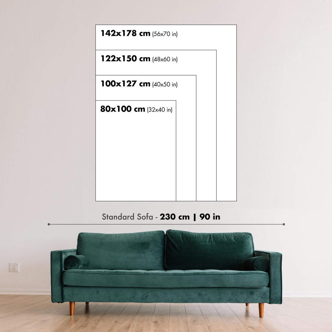
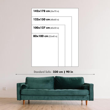
Detailed maps are especially rewarding at larger sizes, where names, boundaries and decorative features have more room to be appreciated. Use the close-up preview and size guide to choose the right scale for your wall.
This map looks amazing at sizes all the way up to 50in (125cm). If you are looking for a larger map, please get in touch.
The model in the listing images is holding the 16x20in (40x50cm) version of this map.
Where personalisation is available, you can add a short title or dedication, mark one meaningful place, or request one considered visual detail. See personalised map examples.
Every piece is printed to museum-grade archival standards using fade-resistant pigment inks on acid-free matte paper. Choose an unframed map print, framed map or canvas using the finish options above. Framed maps use crystal-clear optical acrylic and arrive ready to hang.
With its rich detail and strong sense of place, this map makes a considered gift for a new home, anniversary, retirement or anyone with a personal connection to the area shown. Still deciding? Explore our collection of rare old and vintage maps to discover another place, period or style.
This map is also available as a float framed canvas, sometimes known as a shadow gap framed canvas or canvas floater. The map is printed on artist's cotton canvas and then stretched over a handmade box frame. We then "float" the canvas inside a wooden frame, which is available in a range of colours (black, dark brown, oak, antique gold and white). This is a wonderful way to present a map without glazing in front. See some examples of float framed canvas maps and explore the differences between my different finishes.
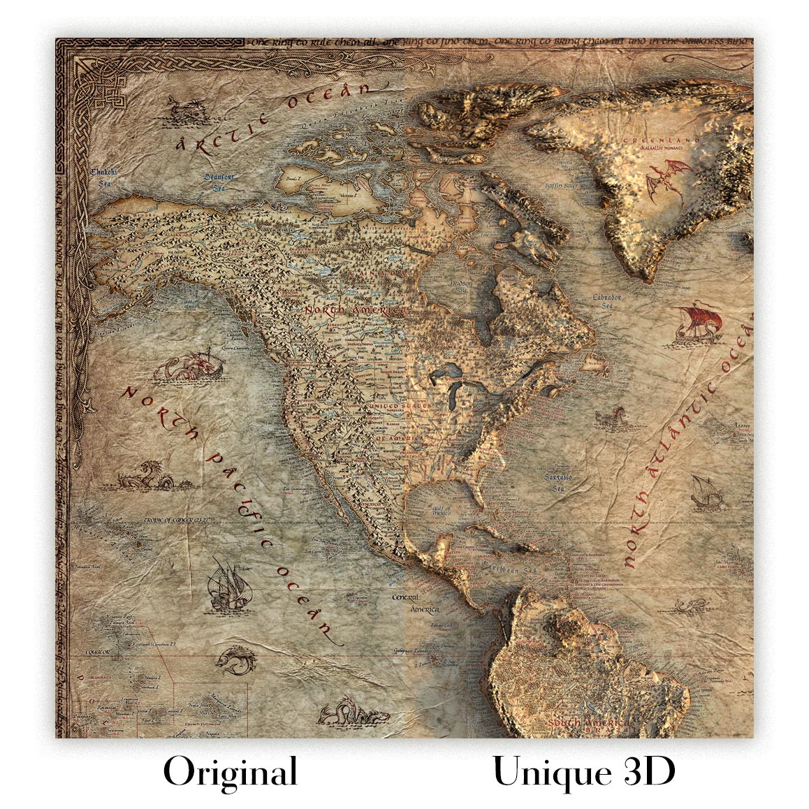
For something truly unique, this map is also available in "Unique 3D", our trademarked process that dramatically transforms the map so that it has a wonderful sense of depth. We combine the original map with detailed topography and elevation data, so that mountains and the terrain really "pop". For more info and examples of 3D maps, check my Unique 3D page.
Published in 1957 using survey data gathered in 1954, “East Point” is a revealing U.S. Geological Survey portrait of Atlanta’s southwestern approaches at a pivotal mid-century moment. At a 1:24,000 scale, the map captures Atlanta, East Point, Hapeville, College Park, Fort McPherson, and the road and rail corridors that tied them together before the full force of postwar metropolitan expansion reshaped the region. Its original title is elegantly understated, yet the sheet encompasses a complex urban landscape: established neighborhoods, military grounds, industrial arteries, airport facilities, and rolling Georgia terrain. As a historical document, it preserves the texture of a city in transition, showing Atlanta not as the sprawling metropolis it would become, but as a dense regional hub pressing outward along transportation lines.
The U.S. Geological Survey brought to this map the precision and disciplined visual language that made its mid-twentieth-century topographic sheets indispensable to planners, engineers, hikers, historians, and government agencies. The cartography is clean and authoritative, balancing urban detail with physical geography: red emphasizes built environments, major roads, and infrastructure, while softer tones distinguish vegetation and open land. Contour lines describe the undulating Piedmont terrain, revealing how Atlanta’s neighborhoods and transportation routes were shaped by ridges, lowlands, and drainage patterns. The result is more than a street-and-place map; it is a layered technical portrait of land use, elevation, settlement, and movement, rendered in the crisp, functional style that defines classic USGS mapping.
Atlanta appears here as the dominant force, its railways and roadways radiating outward from the city and giving the sheet much of its historical energy. The map’s rail corridors are especially significant: Atlanta’s growth had long depended on rail connections, and East Point itself developed as a junction community where transportation and industry encouraged settlement. Roads such as Campbellton Road and Jonesboro Road anchor the geography of everyday movement, linking residential districts, commercial nodes, and outlying communities. South Adamsville and other neighborhood areas evoke the city’s expanding western and southern edges. Read closely, the map shows a landscape poised between older rail-based patterns and the automobile-driven suburban expansion that would soon accelerate across metropolitan Atlanta.
East Point, Hapeville, and College Park form a compelling trio on the southern side of Atlanta, each with its own relationship to transportation, industry, and suburban development. Hapeville’s proximity to the airport made it an important node in the evolving aviation landscape, while College Park grew alongside rail lines and roads that connected it to both Atlanta and the wider region. The airport shown on or near this landscape would later become known globally as Hartsfield-Jackson Atlanta International Airport, one of the busiest air hubs in the world. Fort McPherson, meanwhile, adds a military dimension to the sheet, marking the presence of a major U.S. Army installation whose influence shaped surrounding neighborhoods and infrastructure for generations.
Today, the area depicted on “East Point” has been transformed by urban sprawl, freeway construction, airport expansion, institutional growth, and shifting patterns of residential and commercial development. Modern references such as Interstates 285 and 75/85, along with later landmarks including Atlanta Metropolitan State College, underscore how dramatically the metropolitan fabric has changed since the 1950s. Yet this map preserves an earlier organization of the city, before many contemporary corridors and developments fully defined the landscape. Its careful topographic detail allows the viewer to see the enduring foundations beneath modern Atlanta: the hills and valleys of the Piedmont, the old rail alignments, the historic roads, and the communities whose mid-century forms still echo through the city’s present geography.
Cities, towns and places on this map
- Atlanta, Georgia
- East Point, Georgia
- Hapeville, Georgia
- College Park, Georgia
- Fort McPherson
- Hartsfield-Jackson Atlanta International Airport
- Campbellton Road
- Jonesboro Road
- South Adamsville
- Atlanta Metropolitan State College
- Interstates 285 and 75/85
- Atlanta’s railways
- Various parks and residential neighborhoods
Historical context & cartographic details
- Produced by the US Geological Survey, this historical 1:24,000 topographical map shows Atlanta, Georgia, and the surrounding area.
- The original survey data was collected in 1954 and the map was published in 1957.
- Published by the US Geological Survey, a scientific agency of the U.S. government known for its topographical maps and geological studies.
- The map prominently features Atlanta and nearby areas such as East Point and Hapeville.
- Atlanta is a significant cultural and economic hub in the southeastern United States, while East Point historically developed as a rail junction.
- The map uses a clear color scheme, with shades of yellow for vegetation and red for urban areas and infrastructure.
- Its detailed representation of topographical features reflects the cartographic standards of the 1950s.
- The map shows a mix of urban settings and natural landscapes, including hills and low-lying areas.
- It serves as a snapshot of Atlanta’s development in the mid-20th century, before later urban sprawl and infrastructure changes transformed the landscape.
Looking for a particular place? Review the detailed images to confirm that the town, landmark or feature you have in mind appears on the map. If you are unsure, ask our workshop to check before you order.
Detailed maps are especially rewarding at larger sizes, where names, boundaries and decorative features have more room to be appreciated. Use the close-up preview and size guide to choose the right scale for your wall.
This map looks amazing at sizes all the way up to 50in (125cm). If you are looking for a larger map, please get in touch.
The model in the listing images is holding the 16x20in (40x50cm) version of this map.
Where personalisation is available, you can add a short title or dedication, mark one meaningful place, or request one considered visual detail. See personalised map examples.
Every piece is printed to museum-grade archival standards using fade-resistant pigment inks on acid-free matte paper. Choose an unframed map print, framed map or canvas using the finish options above. Framed maps use crystal-clear optical acrylic and arrive ready to hang.
With its rich detail and strong sense of place, this map makes a considered gift for a new home, anniversary, retirement or anyone with a personal connection to the area shown. Still deciding? Explore our collection of rare old and vintage maps to discover another place, period or style.
This map is also available as a float framed canvas, sometimes known as a shadow gap framed canvas or canvas floater. The map is printed on artist's cotton canvas and then stretched over a handmade box frame. We then "float" the canvas inside a wooden frame, which is available in a range of colours (black, dark brown, oak, antique gold and white). This is a wonderful way to present a map without glazing in front. See some examples of float framed canvas maps and explore the differences between my different finishes.
For something truly unique, this map is also available in "Unique 3D", our trademarked process that dramatically transforms the map so that it has a wonderful sense of depth. We combine the original map with detailed topography and elevation data, so that mountains and the terrain really "pop". For more info and examples of 3D maps, check my Unique 3D page.
Viele unserer Karten und Kunstdrucke werden als durchdachte Geschenke für Wohnungen, Büros, Arbeitszimmer und bedeutungsvolle Orte ausgewählt.
Wählen Sie eine gerahmte Option als das einfachste, fertig zum Aufhängen gelieferte Geschenk, oder entscheiden Sie sich für einen ungerahmten Druck, wenn der Empfänger seinen eigenen Rahmen lieber selbst auswählen möchte.
Wir fertigen Bestellungen lokal in 23 Ländern weltweit, sodass Geschenke oft in der Nähe des Empfängers produziert werden können. Das trägt dazu bei, dass sie schneller ankommen, sicherer transportiert werden und Überraschungen durch Zoll oder Einfuhrabgaben vermieden werden.
- Wir können direkt an den Empfänger liefern
- Gerahmte Werke werden fertig zum Aufhängen geliefert
- Ungerahmte Drucke werden sorgfältig in einer stabilen Schutzhülle versandt
- Nahezu jede Bestellung wird lokal gefertigt – für schnelleres und sichereres Schenken
- 90 Tage Rückgaberecht geben dem Empfänger Zeit für seine Entscheidung
Wenn Sie nicht sicher sind, was Sie wählen sollen, kontaktieren Sie uns bitte. Wir helfen Ihnen gern dabei, die passende Karte, Größe, Ausführung oder Lieferoption auszuwählen.
Für die meisten Bestellungen beträgt die Lieferzeit etwa 3 Werktage. Personalisierte und maßgeschneiderte Produkte benötigen länger, da ich die Personalisierung durchführen und sie Ihnen zur Genehmigung zusenden muss, was normalerweise 1 oder 2 Tage dauert.
Bitte beachten Sie, dass sehr große gerahmte Bestellungen in der Regel länger für die Herstellung und Lieferung benötigen.
Wenn Sie möchten, dass Ihre Bestellung bis zu einem bestimmten Datum ankommt, bitte kontaktieren Sie mich, bevor Sie bestellen, damit wir den besten Weg finden können, um sicherzustellen, dass Sie Ihre Bestellung rechtzeitig erhalten.
Ich drucke und rahme Karten und Kunstwerke in 23 Ländern weltweit. Das bedeutet, dass Ihre Bestellung lokal gefertigt wird, was die Lieferzeit verkürzt und sicherstellt, dass sie während der Lieferung nicht beschädigt wird. Sie zahlen nie Zoll oder Einfuhrgebühren, und wir stoßen weniger CO2 in die Luft aus.
Alle meine Karten und Kunstdrucke sind gut verpackt und werden in einem robusten Rohr versendet, wenn sie ungerahmt sind, oder von Schaum umgeben, wenn sie gerahmt sind.
Ich versuche, alle Bestellungen innerhalb von 1 oder 2 Tagen nach Erhalt Ihrer Bestellung zu versenden, obwohl einige Produkte (wie Gesichtsmasken, Tassen und Tragetaschen) länger zur Herstellung benötigen können.
Wenn Sie Express-Lieferung an der Kasse auswählen, priorisieren wir Ihre Bestellung und versenden sie per 1-Tages-Kurier (Fedex, DHL, UPS, Parcelforce).
Nächster Tag Lieferung ist auch in einigen Ländern verfügbar (USA, UK, Singapur, VAE), aber bitte versuchen Sie, früh am Tag zu bestellen, damit wir es rechtzeitig versenden können.
Lesen Sie meinen vollständigen Leitfaden zur Lieferung und lokalen Produktion
Mein Standardrahmen ist ein Galerie-Stil-Rahmen aus schwarzem Eschenholz. Er ist einfach und sieht ziemlich modern aus. Mein Standardrahmen ist etwa 20 mm (0,8 Zoll) breit.
Ich verwende super-klares Acryl (Plexiglas/Acrylt) für das Glas des Rahmens. Es ist leichter und sicherer als Glas – und es sieht besser aus, da die Reflexion geringer ist.
Sechs Standardrahmenfarben sind kostenlos erhältlich (schwarz, dunkelbraun, dunkelgrau, Eiche, weiß und antikgold).
Die meisten Karten, Kunstwerke und Illustrationen sind auch als gerahmte Leinwand erhältlich. Wir verwenden matte (nicht glänzende) Baumwollleinwand, spannen sie über einen nachhaltig beschafften Buchenrahmen und 'schweben' dann das Stück innerhalb eines Holzrahmens. Das Endergebnis ist ziemlich schön, und es gibt keine Verglasung, die im Weg ist.
Alle Rahmen werden "bereit zum Aufhängen" geliefert, entweder mit einer Schnur oder Halterungen auf der Rückseite. Sehr große Rahmen haben schwere Aufhängeplatten und/oder eine Montageschiene. Wenn Sie Fragen haben, können Sie bitte Kontakt aufnehmen.
Sehen Sie sich einige Beispiele meiner gerahmten Karten und gerahmten Leinwandkarten an.
Alternativ kann ich auch alte Karten und Kunstwerke auf Leinwand, Schaumstoffplatten, Baumwollrag und andere Materialien liefern.
Wenn Sie Ihre Karte oder Ihr Kunstwerk selbst rahmen möchten, lesen Sie bitte zuerst meinen Größenleitfaden.
Wir arbeiten mit Innenarchitekten, Unternehmen aus dem Gastgewerbe, Immobilienfachleuten, Büros und Firmenkunden an Einzelstücken sowie an größeren, abgestimmten Projekten.
Diese Karte kann an eine bestimmte Wand, einen Raum oder ein Projekt angepasst werden, und unsere Werkstatt unterstützt Sie vor der Produktion bei der Abstimmung von Abmessungen, Material und Rahmung.
- Exakte, übergroße und maßgefertigte Abmessungen
- Individuelle Rahmung, Montage und alternative Materialien
- Abgestimmte Stücke für mehrere Räume oder Standorte
- Personalisierung der Karte, um wichtige Orte zu markieren oder zusätzliche Details hinzuzufügen
- Beratung zu Karte und Rahmung durch unsere Werkstatt
- Lokale Produktion für Projekte in aller Welt
Besprechen Sie dieses Werk mit unserem Team für Trade & Projects
Meine Karten sind äußerst hochwertige Reproduktionen von Originalkarten.
Ich beziehe originale, seltene Karten aus Bibliotheken, Auktionshäusern und Privatsammlungen auf der ganzen Welt, restauriere sie in meiner Londoner Werkstatt und erstelle dann mit speziellen Giclée-Tinten und -Druckern wunderschöne Karten, die sogar noch besser aussehen als das Original.
Meine Karten werden auf säurefreiem, mattem Archivpapier (nicht glänzend) gedruckt, das sich sehr hochwertig anfühlt und fast wie Karton aussieht. Technisch gesehen beträgt das Papiergewicht/die Papierdicke 10mil/200g/m². Es eignet sich perfekt zum Einrahmen.
Ich drucke mit UV-lichtbeständigen Ultrachrome-Giclée-Pigmenttinten von Epson – einige der besten Tinten, die Sie finden können.
Ich kann auch machen Karten auf Leinwand, Baumwolllappen und andere exotische Materialien.
Erfahren Sie mehr über The Unique Maps Co.
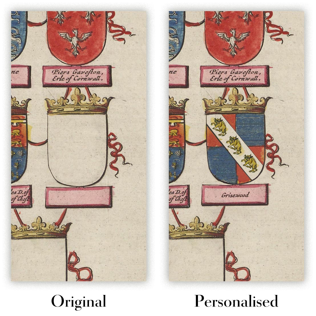
Kartenpersonalisierung
Wenn Sie nach dem perfekten Geschenk zum Jahrestag oder zur Einweihung suchen, kann ich Ihre Karte personalisieren, um sie wirklich einzigartig zu machen. Ich kann beispielsweise eine kurze Nachricht hinzufügen, einen wichtigen Ort hervorheben oder das Wappen Ihrer Familie hinzufügen.
Die Möglichkeiten sind nahezu unbegrenzt. Bitte sehen Sie sich meine Kartenpersonalisierungsseite für einige wunderbare Beispiele dessen, was möglich ist.
Um eine personalisierte Karte zu bestellen, wählen Sie „Personalisieren Sie Ihre Karte“, bevor Sie sie in den Warenkorb legen.
In Kontakt kommen wenn Sie nach komplexeren Anpassungen und Personalisierungen suchen.
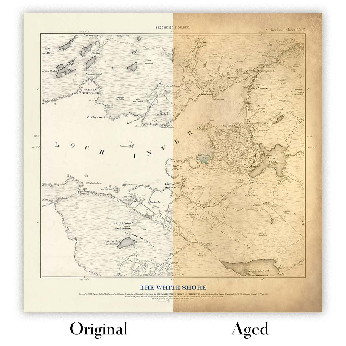
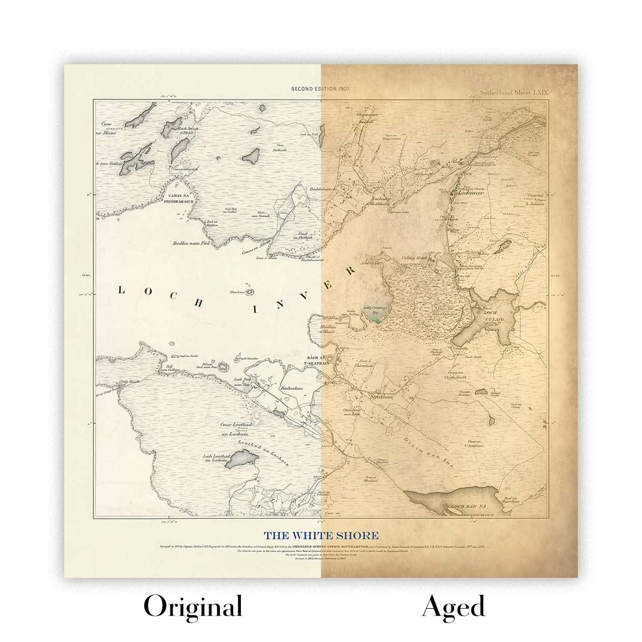
Kartenalterung
Im Laufe der Jahre wurde ich von Kunden hunderte Male gefragt, ob sie eine Karte kaufen könnten, die noch älter.
Nun, jetzt können Sie das, indem Sie „Alter“ auswählen, bevor Sie eine Karte in Ihren Warenkorb legen.
Alle Produktfotos, die Sie auf dieser Seite sehen, zeigen die Karte in ihrer Originalform. So sieht die Karte heute aus.
Wenn Sie „Gealtert“ auswählen, werde ich Ihre Karte von Hand altern lassen. Dazu verwende ich ein spezielles und einzigartiges Verfahren, das ich durch jahrelanges Studium alter Karten und Gespräche mit Forschern zum Verständnis der Chemie alternder Papiere entwickelt habe, und natürlich ... viel Übung!
Wenn Sie sich nicht sicher sind, bleiben Sie bei der Originalfarbe der Karte. Wenn Sie etwas Dunkleres und älter Wenn Sie auf der Suche sind, entscheiden Sie sich für „Aged“.
Sehen Sie einige erstaunliche Beispiele für gealterte Karten.
Seit 1984 restaurieren und fertigen wir Karten und Kunstdrucke an, und wir stehen hinter jedem einzelnen Stück.
Jede Bestellung ist durch unsere 10-Jahres-Garantie und unsere Garantie für beschädigungsfreie Lieferung abgesichert. Sollte Ihr Stück beschädigt bei Ihnen ankommen, ersetzen oder reproduzieren wir es kostenlos. Sollte sonst etwas nicht in Ordnung sein, kontaktieren Sie unser Werkstatt-Team, und wir kümmern uns umgehend darum.
Ausführliche Informationen finden Sie in unseren Rückgabe- und Erstattungsrichtlinien.


