


Old Map of The Silk Road, 1640 by Willem Blaeu & The Unique Maps Co.
Buy 2, Get 1 Free
If you add 2 items to your bag, you can add a third product for free. The discount is automatic - no code required.
This is equivalent to 33% off, which will be the largest discount available on my shop this year.
This works for all maps and artwork. You can order 3 of the same thing, or 3 different things.
My custom maps are excluded, as they're too time consuming to make and we'd prefer to take our time rather than rush through a lot of orders.
Please take advantage of the deal and buy lots of beautiful maps and art for your walls.
Contact me if you have any questions.

-
![]() Handmade in the UK (we're based in London)
Handmade in the UK (we're based in London)
-
FREE worldwide delivery in 2-3 days ⓘ
Free delivery in 2-3 days
Your map should be delivered in 2-3 working days with free delivery, worldwide.
Deliveries over the Christmas and New Year period may be slightly delayed, as couriers and postal services catch up with a huge backlog of packages.
We make maps by hand locally in 23 countries, including the UK
![]() . If you're buying a gift for someone in another country, we will make the map locally to them.
. If you're buying a gift for someone in another country, we will make the map locally to them.You will never pay import tax or customs duty.
Express delivery is available at checkout which can reduce the delivery time to 1-2 days.
Please note that personalised maps, and larger framed maps, can take longer to produce and deliver.
If you need your order to arrive by a certain date, contact me and we can discuss your options.
-
FREE gift preview
ⓘ
Digital gift preview
After you complete your order, you can send a beautiful digital preview to the gift recipient. Just provide their email address and we'll do the rest. (Their email address will not be stored or used for any other purpose.)
This is perfect if you're concerned that your order might not arrive in time.
You can also buy a real non-expiring gift card, and email it directly to the recipient, so they can buy their own map or artwork.
-
90 day money back guarantee
ⓘ
90 days to return and refund
Products can be returned within 90 days for a full refund, or exchange for another product.
For personalised and custom made items, we may offer you store credit or a non-expiring gift card, as we cannot resell personalised orders.
If you have any questions, get in touch. For more information, see our full returns & exchanges policy.

My maps are rare, museum-grade, restored old maps sourced from libraries, auction houses and private collections across the globe.
Framing & free personalisation available
1. Select your size
Click here to order a custom size.
2. Frame & personalise your map
Make your map unique with framing, hand-drawn customisation, vintage ageing, pop art text, unique 3D styling and more.


Gift message & custom finish

If you want to add a gift message, or a finish (jigsaw, aluminium board, etc.) that is not available here, please request it in the "order note" when you check out.
Every order is custom made, so if you need the size adjusted slightly, or printed on an unusual material, just let us know. We've done thousands of custom orders over the years, so there's (almost) nothing we can't manage.
You can also contact us before you order, if you prefer!

- Handmade locally. No import duty or tax
- FREE worldwide delivery
- Love it or your money back (90 days)
- Questions? WhatsApp me any time
Own a piece of history
5,000+ 5 star reviews


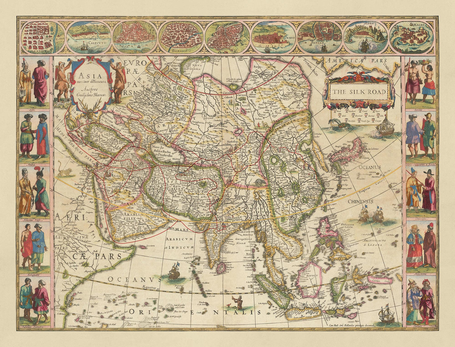
Step into the rich tapestry of history with this exquisite map of The Silk Road, masterfully designed The Unique Maps Co. in 2024, and based on a map of Asia by renowned cartographer Willem Blaeu in 1640.
This map uniquely overlays a modern-day depiction of the Silk Road onto Blaeu's ancient map of Asia, offering a fascinating blend of historical and contemporary perspectives. The Silk Road, a legendary network of trade routes, connected the East and West, facilitating not only the exchange of goods but also the interchange of culture, technology, and ideas. This map captures the essence of this vibrant historical artery, making it an invaluable piece for any history enthusiast or collector.
One of the most captivating features of this map is the detailed illustrations that adorn the Silk Road. Traders, camels, and other iconic symbols of ancient trade are meticulously depicted, bringing to life the bustling activity that once thrived along these routes. The map also includes a comprehensive legend in the top right corner, highlighting the diverse array of products that moved along the Silk Road, such as wool, silk, qashani, camels, paper, gold, elephants, incense, porcelain, purple dye, and carpets. These illustrations and legends not only enhance the visual appeal of the map but also provide a deeper understanding of the historical significance of the Silk Road.
The map showcases the vast expanse of regions and countries that were interconnected by the Silk Road, including China, India, Persia, and parts of the Middle East. Major cities such as Samarkand, Kashgar, and Xi'an are prominently featured, each playing a crucial role in the trade network. The intricate detailing of topographical features, such as mountains and rivers, adds to the authenticity and historical accuracy of the map. This geographical representation offers a glimpse into the diverse landscapes that traders traversed, further enriching the narrative of the Silk Road.
Willem Blaeu's artistic prowess is evident in the decorative elements that frame the map. The borders are adorned with illustrations of people, events, and cultural exchanges, reflecting the rich interactions that occurred along the Silk Road. The map is also embellished with decorative cartouches and scrollwork, adding a touch of elegance and grandeur. Maritime routes and ships depicted in the surrounding oceans highlight the importance of sea trade in complementing the overland routes of the Silk Road. These artistic elements not only enhance the aesthetic appeal of the map but also provide a visual narrative of the historical context.
The historical significance of this map cannot be overstated. The Silk Road was instrumental in shaping the course of history, fostering economic and cultural exchanges that have left an indelible mark on civilizations. This map serves as a testament to the enduring legacy of the Silk Road, capturing the essence of a bygone era that brought the far east to Europe. For collectors, historians, or anyone with a passion for the rich tapestry of human history, this map is a treasure trove of knowledge and beauty, offering a window into the past and a deeper appreciation of the interconnected world we live in today.
The Journey of the Silk Road: Trade and Culture
The Silk Road, established during the Han Dynasty around the 2nd century BCE, was a significant network of trade routes connecting the East and West. It fostered not only commerce but also cultural and knowledge exchange. Originating in China, the Silk Road facilitated the trade of exquisite silk, which was highly coveted in distant lands. Additionally, China introduced other significant goods such as porcelain, paper, tea, and spices.
As the route extended westward, various regions contributed valuable commodities: India provided fine cotton textiles, spices, and gems. Indian merchants also brought with them the knowledge of Buddhism spreading to other parts of Asia. Persia (modern-day Iran) offered intricate carpets, exquisite ceramics, and saffron.
The journey continued through the Middle East where Arabian merchants traded incense, myrrh, and frankincense, highly valued for their use in religious ceremonies and perfumery. Additionally, the Arab traders brought scientific knowledge, including advancements in mathematics and astronomy, which would later influence the Renaissance in Europe.
Cities in Central Asia, such as Samarkand and Bukhara, thrived as bustling trade centers, exchanging items like lapis lazuli and horses. Istanbul, formerly Byzantium and Constantinople, emerged as a crucial hub, linking the Silk Road with Europe and facilitating the flow of spices, metals, and textiles.
Finally, the Silk Road extended its influence into Europe. While Europe primarily imported goods like silk, spices, and precious stones, it also contributed items such as glassware, woolen textiles, and wine. European merchants, driven by the allure of Eastern riches, embarked on perilous journeys to bring these treasures back to their homelands.
Beyond being a mere trade route, the Silk Road was instrumental in fostering cultural exchange, religious spread, and scientific advancements, thereby enriching the civilizations it connected. Although its prominence waned with the rise of maritime trade routes, the legacy of the Silk Road endures as a testament to the interconnectedness of human civilization and the enduring spirit of exploration and exchange.
Places on this map
- Samarkand
- Kashgar
- Xi'an
- Persia
- China
- India
- Arabia Felix
- Cathay
- Borneo
- Sumatra
- Java
- Tartary
- Mesopotamia
- Armenia
- Syria
- Egypt
- Turkey
- Mongolia
- Tibet
- Malacca
- Kazahkstan
Notable Features & Landmarks
- Illustrations of traders and camels along the Silk Road
- Legend in the top right corner showing different products moved along the Silk Road
- Matching icons on the Silk Road route indicating specific trade products
- Detailed illustrations and depictions of cities and regions
- Major trade routes highlighted
- Various regions of Asia, including China, India, Persia, and the Middle East
- Historic cities and landmarks
- Artistic borders with additional illustrations of people and events
- Maritime routes and ships depicted in the surrounding oceans
- Decorative cartouches and scrollwork
- The map is titled "The Silk Road" prominently in the top right
- Detailed topographical features such as mountains and rivers
- Major cities along the Silk Road such as Samarkand, Kashgar, and Xi'an
- Illustrations of cultural exchanges and interactions
- Depictions of different ethnic groups and their attire
- Artistic representation of the ancient trade environment
- Insets of significant locations or events along the Silk Road
- Compass rose for orientation
- Borders and territories as understood in the 17th century
- Artistic representation of flora and fauna
- Map scale and distance markers
- Illustrations of ancient trade goods like silk, wool, and gold
Historical and design context
- This is a modern-day map of the Silk Road created by The Unique Maps Co., overlaid on an ancient map of Asia by Willem Blaeu.
- There were no maps of the Silk Road published in antiquity, making this a unique map, possibly the first of its kind.
- Delightful illustrations can be found along the Silk Road of traders, camels, etc.
- There is a helpful legend in the top right corner showing the different products that moved along the Silk Road, including Wool, Silk, Qashani, Camels, Paper, Gold, Elephant, Incense, Porcelain, Purple Dye, and Carpet.
- Matching icons on the Silk Road route indicate which products moved along which parts of the Silk Road.
- An amazing map for anyone interested in the history of Asia and how the Silk Road eventually brought ‘the far east’ to Europe.
- Willem Blaeu was a notable Dutch cartographer, atlas maker, and publisher in the 17th century.
- The Silk Road was a network of trade routes connecting the East and West from the 2nd century BCE to the 18th century.
- It played a crucial role in the cultural, commercial, and technological exchange between the regions.
- The map features a combination of ancient cartographic design with modern overlays.
- Rich illustrations and detailed legend.
- The Silk Road was instrumental in shaping the course of history, fostering economic and cultural exchanges that have left an indelible mark on civilizations.
Please double check the images to make sure that a specific town or place is shown on this map. You can also get in touch and ask us to check the map for you.
This map looks great at every size, but I always recommend going for a larger size if you have space. That way you can easily make out all of the details.
This map looks amazing at sizes all the way up to 90in (230cm). If you are looking for a larger map, please get in touch.
Please note: the labels on this map are hard to read if you order a map that is 16in (40cm) or smaller. The map is still very attractive, but if you would like to read the map easily, please buy a larger size.
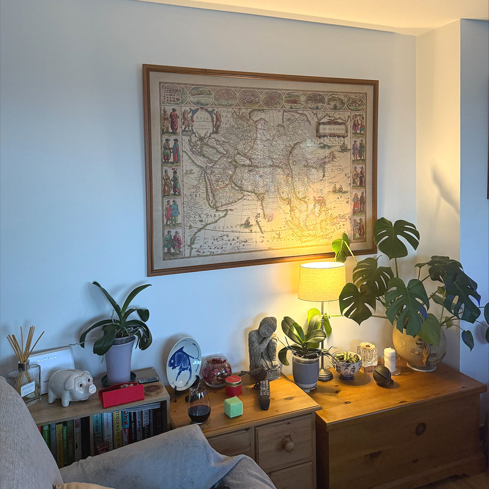
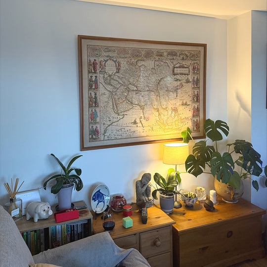
The model in the listing images is holding the 18x24in (45x60cm) version of this map.
The fifth listing image shows an example of my map personalisation service.
If you’re looking for something slightly different, check out my collection of the best old maps to see if something else catches your eye.
Please contact me to check if a certain location, landmark or feature is shown on this map.
This would make a wonderful birthday, Christmas, Father's Day, work leaving, anniversary or housewarming gift for someone from the areas covered by this map.
This map is available as a giclée print on acid free archival matte paper, or you can buy it framed. The frame is a nice, simple black frame that suits most aesthetics. Please get in touch if you'd like a different frame colour or material. My frames are glazed with super-clear museum-grade acrylic (perspex/acrylite), which is significantly less reflective than glass, safer, and will always arrive in perfect condition.
This map is also available as a float framed canvas, sometimes known as a shadow gap framed canvas or canvas floater. The map is printed on artist's cotton canvas and then stretched over a handmade box frame. We then "float" the canvas inside a wooden frame, which is available in a range of colours (black, dark brown, oak, antique gold and white). This is a wonderful way to present a map without glazing in front. See some examples of float framed canvas maps and explore the differences between my different finishes.
For something truly unique, this map is also available in "Unique 3D", our trademarked process that dramatically transforms the map so that it has a wonderful sense of depth. We combine the original map with detailed topography and elevation data, so that mountains and the terrain really "pop". For more info and examples of 3D maps, check my Unique 3D page.
For most orders, delivery time is about 3 working days. Personalised and customised products take longer, as I have to do the personalisation and send it to you for approval, which usually takes 1 or 2 days.
Please note that very large framed orders usually take longer to make and deliver.
If you need your order to arrive by a certain date, please contact me before you order so that we can find the best way of making sure you get your order in time.
I print and frame maps and artwork in 23 countries around the world. This means your order will be made locally, which cuts down on delivery time and ensures that it won't be damaged during delivery. You'll never pay customs or import duty, and we'll put less CO2 into the air.
All of my maps and art prints are well packaged and sent in a rugged tube if unframed, or surrounded by foam if framed.
I try to send out all orders within 1 or 2 days of receiving your order, though some products (like face masks, mugs and tote bags) can take longer to make.
If you select Express Delivery at checkout your order we will prioritise your order and send it out by 1-day courier (Fedex, DHL, UPS, Parcelforce).
Next Day delivery is also available in some countries (US, UK, Singapore, UAE) but please try to order early in the day so that we can get it sent out on time.
My standard frame is a gallery style black ash hardwood frame. It is simple and quite modern looking. My standard frame is around 20mm (0.8in) wide.
I use super-clear acrylic (perspex/acrylite) for the frame glass. It's lighter and safer than glass - and it looks better, as the reflectivity is lower.
Six standard frame colours are available for free (black, dark brown, dark grey, oak, white and antique gold). Custom framing and mounting/matting is available if you're looking for something else.
Most maps, art and illustrations are also available as a framed canvas. We use matte (not shiny) cotton canvas, stretch it over a sustainably sourced box wood frame, and then 'float' the piece within a wood frame. The end result is quite beautiful, and there's no glazing to get in the way.
All frames are provided "ready to hang", with either a string or brackets on the back. Very large frames will have heavy duty hanging plates and/or a mounting baton. If you have any questions, please get in touch.
See some examples of my framed maps and framed canvas maps.
Alternatively, I can also supply old maps and artwork on canvas, foam board, cotton rag and other materials.
If you want to frame your map or artwork yourself, please read my size guide first.
My maps are extremely high quality reproductions of original maps.
I source original, rare maps from libraries, auction houses and private collections around the world, restore them at my London workshop, and then use specialist giclée inks and printers to create beautiful maps that look even better than the original.
My maps are printed on acid-free archival matte (not glossy) paper that feels very high quality and almost like card. In technical terms the paper weight/thickness is 10mil/200gsm. It's perfect for framing.
I print with Epson ultrachrome giclée UV fade resistant pigment inks - some of the best inks you can find.
I can also make maps on canvas, cotton rag and other exotic materials.
Learn more about The Unique Maps Co.
Map personalisation
If you're looking for the perfect anniversary or housewarming gift, I can personalise your map to make it truly unique. For example, I can add a short message, or highlight an important location, or add your family's coat of arms.
The options are almost infinite. Please see my map personalisation page for some wonderful examples of what's possible.
To order a personalised map, select "personalise your map" before adding it to your basket.
Get in touch if you're looking for more complex customisations and personalisations.
Map ageing
I have been asked hundreds of times over the years by customers if they could buy a map that looks even older.
Well, now you can, by selecting Aged before you add a map to your basket.
All the product photos you see on this page show the map in its Original form. This is what the map looks like today.
If you select Aged, I will age your map by hand, using a special and unique process developed through years of studying old maps, talking to researchers to understand the chemistry of aging paper, and of course... lots of practice!
If you're unsure, stick to the Original colour of the map. If you want something a bit darker and older looking, go for Aged.
If you are not happy with your order for any reason, contact me and I'll get it fixed ASAP, free of charge. Please see my returns and refund policy for more information.
I am very confident you will like your restored map or art print. I have been doing this since 1984. I'm a 5-star Etsy seller. I have sold tens of thousands of maps and art prints and have over 5,000 real 5-star reviews. My work has been featured in interior design magazines, on the BBC, and on the walls of dozens of 5-star hotels.
I use a unique process to restore maps and artwork that is massively time consuming and labour intensive. Hunting down the original maps and illustrations can take months. I use state of the art and eye-wateringly expensive technology to scan and restore them. As a result, I guarantee my maps and art prints are a cut above the rest. I stand by my products and will always make sure you're 100% happy with what you receive.
Almost all of my maps and art prints look amazing at large sizes (200cm, 6.5ft+) and I can frame and deliver them to you as well, via special oversized courier. Contact me to discuss your specific needs.
Or try searching for something!


