- Handmade locally. No import duty or tax
- FREE worldwide delivery
- 90-day returns & 5-year product guarantee
- Questions? WhatsApp me any time
Own a piece of history
7,000+ 5 star reviews


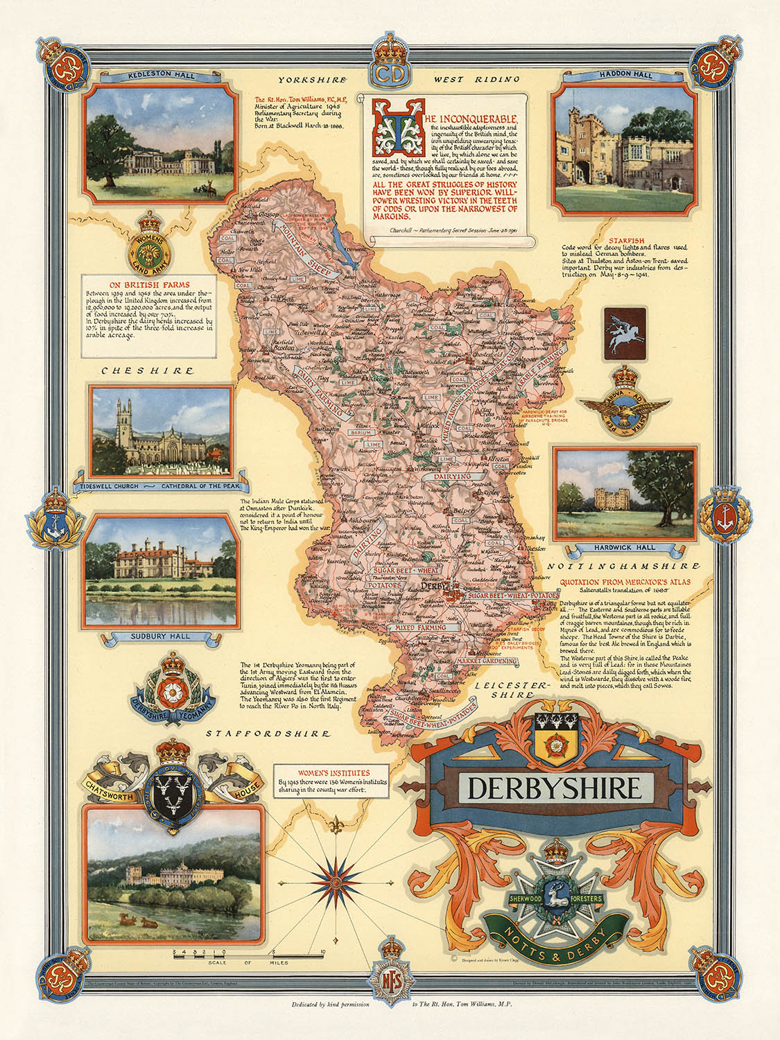
Step into the rich tapestry of Derbyshire's history with this exquisite 1946 map, masterfully designed and drawn by the renowned cartographer Ernest Clegg. This pictorial map, titled simply "Derbyshire," captures the essence of the county with a unique blend of artistry and precision. Clegg's dedication to detail is evident in the intricate vignettes of iconic landmarks such as Chatsworth, Kedleston, Hardwick, Haddon, and Sudbury Halls, as well as Tideswell Church, often referred to as the Cathedral of the Peak. Each vignette is a window into the architectural splendor and historical significance of these sites, making the map not just a navigational tool but a visual journey through time.
Ernest Clegg, a distinguished figure in the world of cartography, is celebrated for his ability to infuse maps with cultural and historical narratives. His work on this Derbyshire map is no exception. Created in the aftermath of World War II, the map is a testament to the resilience and contributions of the British people during a time of great adversity. It includes poignant notes on British farms and the Women's Institute, highlighting their crucial roles during the war. The inclusion of a quote by Sir Winston Churchill from June 25, 1941, further underscores the map's historical context, serving as a reminder of the nation's indomitable spirit.
The design of the map is a harmonious blend of thematic and pictorial elements, showcasing Clegg's artistic prowess. The relief shading brings the topography of Derbyshire to life, offering a tactile sense of the county's varied landscape. The city coats of arms, meticulously illustrated, add a heraldic touch that speaks to the region's rich heritage. The compass rose, elegantly designed, anchors the map in a tradition of nautical and cartographic excellence. Every element, from the decorative border to the detailed depictions of towns and rivers, reflects Clegg's commitment to creating a map that is both beautiful and informative.
Derbyshire itself is a county steeped in history and natural beauty, and this map captures its essence with remarkable fidelity. From the bustling city of Derby to the serene landscapes of the Peak District, the map charts a course through a region known for its picturesque towns and historic landmarks. The rivers that weave through the county, the shaded relief indicating rolling hills and valleys, and the carefully marked points of interest all contribute to a comprehensive portrayal of Derbyshire. This map is not just a guide but a celebration of the county's enduring charm and significance.
In addition to its aesthetic and historical value, the map serves as a tribute to the people and places that define Derbyshire. The dedication to the Rt Hon. Tom Williams, M.P., and the notes on the Women's Institutes, emphasize the communal and agricultural contributions that were vital during World War II. This map is a testament to the collective effort and resilience of the Derbyshire community, making it a cherished piece for historians, collectors, and anyone with an appreciation for the art of cartography.
Cities and towns on this map
- Derbyshire:
- Derby
- Chesterfield
- Ilkeston
- Long Eaton
- Swadlincote
- Heanor
- Ripley
- Glossop
- Belper
- Buxton
- Alfreton
- Matlock
- Ashbourne
- Dronfield
- Staveley
- Bolsover
- Shirebrook
- Clay Cross
- New Mills
- Whaley Bridge
Notable Features & Landmarks
- Chatsworth House
- Kedleston Hall
- Hardwick Hall
- Haddon Hall
- Sudbury Hall
- Tideswell Church (Cathedral of the Peak)
- Quotes by Sir Winston Churchill
- Notes on British Farms during WWII
- Notes on Women's Institutes during WWII
- City coats of arms
- Relief shading to indicate topography
- Compass rose design
- Decorative border with heraldic elements
Historical and design context
- Name of the map: Derbyshire
- When the map was made: 1946
- Mapmaker or publisher: Ernest Clegg
- Context about the mapmaker: Ernest Clegg was known for his detailed and artistic cartographic works, often incorporating historical and cultural elements.
- Topics and themes shown on the map:
- Historic landmarks and architecture
- Agricultural significance and contributions during WWII
- Women's Institute activities
- Inspirational quotes and dedications
- Countries and regions shown on the map: Derbyshire, England
- Design or style of the map:
- Thematic and pictorial with artistic vignettes
- High level of detail in depicting landmarks and coats of arms
- Shaded relief to show topography
- Historical significance or context of the map:
- Created in the aftermath of WWII, highlighting the contributions of British farms and the Women's Institute during the war.
- Reflects a period of national pride and resilience, as evidenced by the quotes from Winston Churchill.
Please double check the images to make sure that a specific town or place is shown on this map. You can also get in touch and ask us to check the map for you.
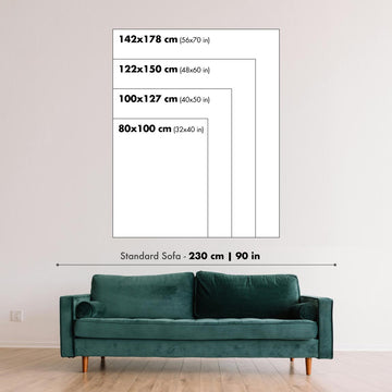
This map looks great at every size, but I always recommend going for a larger size if you have space. That way you can easily make out all of the details.
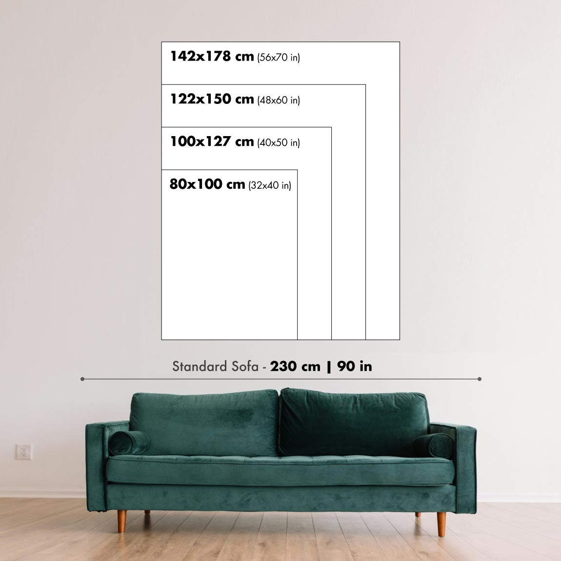
This map looks amazing at sizes all the way up to 70in (180cm). If you are looking for a larger map, please get in touch.
The model in the listing images is holding the 18x24in (45x60cm) version of this map.
The fifth listing image shows an example of my map personalisation service.
If you’re looking for something slightly different, check out my collection of the best old maps to see if something else catches your eye.
Please contact me to check if a certain location, landmark or feature is shown on this map.
This would make a wonderful birthday, Christmas, Father's Day, work leaving, anniversary or housewarming gift for someone from the areas covered by this map.
This map is available as a giclée print on acid free archival matte paper, or you can buy it framed. The frame is a nice, simple black frame that suits most aesthetics. Please get in touch if you'd like a different frame colour or material. My frames are glazed with super-clear museum-grade acrylic (perspex/acrylite), which is significantly less reflective than glass, safer, and will always arrive in perfect condition.
This map is also available as a float framed canvas, sometimes known as a shadow gap framed canvas or canvas floater. The map is printed on artist's cotton canvas and then stretched over a handmade box frame. We then "float" the canvas inside a wooden frame, which is available in a range of colours (black, dark brown, oak, antique gold and white). This is a wonderful way to present a map without glazing in front. See some examples of float framed canvas maps and explore the differences between my different finishes.
For something truly unique, this map is also available in "Unique 3D", our trademarked process that dramatically transforms the map so that it has a wonderful sense of depth. We combine the original map with detailed topography and elevation data, so that mountains and the terrain really "pop". For more info and examples of 3D maps, check my Unique 3D page.
For most orders, delivery time is about 3 working days. Personalised and customised products take longer, as I have to do the personalisation and send it to you for approval, which usually takes 1 or 2 days.
Please note that very large framed orders usually take longer to make and deliver.
If you need your order to arrive by a certain date, please contact me before you order so that we can find the best way of making sure you get your order in time.
I print and frame maps and artwork in 23 countries around the world. This means your order will be made locally, which cuts down on delivery time and ensures that it won't be damaged during delivery. You'll never pay customs or import duty, and we'll put less CO2 into the air.
All of my maps and art prints are well packaged and sent in a rugged tube if unframed, or surrounded by foam if framed.
I try to send out all orders within 1 or 2 days of receiving your order, though some products (like face masks, mugs and tote bags) can take longer to make.
If you select Express Delivery at checkout your order we will prioritise your order and send it out by 1-day courier (Fedex, DHL, UPS, Parcelforce).
Next Day delivery is also available in some countries (US, UK, Singapore, UAE) but please try to order early in the day so that we can get it sent out on time.
My standard frame is a gallery style black ash hardwood frame. It is simple and quite modern looking. My standard frame is around 20mm (0.8in) wide.
I use super-clear acrylic (perspex/acrylite) for the frame glass. It's lighter and safer than glass - and it looks better, as the reflectivity is lower.
Six standard frame colours are available for free (black, dark brown, dark grey, oak, white and antique gold). Custom framing and mounting/matting is available if you're looking for something else.
Most maps, art and illustrations are also available as a framed canvas. We use matte (not shiny) cotton canvas, stretch it over a sustainably sourced box wood frame, and then 'float' the piece within a wood frame. The end result is quite beautiful, and there's no glazing to get in the way.
All frames are provided "ready to hang", with either a string or brackets on the back. Very large frames will have heavy duty hanging plates and/or a mounting baton. If you have any questions, please get in touch.
See some examples of my framed maps and framed canvas maps.
Alternatively, I can also supply old maps and artwork on canvas, foam board, cotton rag and other materials.
If you want to frame your map or artwork yourself, please read my size guide first.
My maps are extremely high quality reproductions of original maps.
I source original, rare maps from libraries, auction houses and private collections around the world, restore them at my London workshop, and then use specialist giclée inks and printers to create beautiful maps that look even better than the original.
My maps are printed on acid-free archival matte (not glossy) paper that feels very high quality and almost like card. In technical terms the paper weight/thickness is 10mil/200gsm. It's perfect for framing.
I print with Epson ultrachrome giclée UV fade resistant pigment inks - some of the best inks you can find.
I can also make maps on canvas, cotton rag and other exotic materials.
Learn more about The Unique Maps Co.
Map personalisation
If you're looking for the perfect anniversary or housewarming gift, I can personalise your map to make it truly unique. For example, I can add a short message, or highlight an important location, or add your family's coat of arms.
The options are almost infinite. Please see my map personalisation page for some wonderful examples of what's possible.
To order a personalised map, select "personalise your map" before adding it to your basket.
Get in touch if you're looking for more complex customisations and personalisations.
Map ageing
I have been asked hundreds of times over the years by customers if they could buy a map that looks even older.
Well, now you can, by selecting Aged before you add a map to your basket.
All the product photos you see on this page show the map in its Original form. This is what the map looks like today.
If you select Aged, I will age your map by hand, using a special and unique process developed through years of studying old maps, talking to researchers to understand the chemistry of aging paper, and of course... lots of practice!
If you're unsure, stick to the Original colour of the map. If you want something a bit darker and older looking, go for Aged.
If you are not happy with your order for any reason, contact me and I'll get it fixed ASAP, free of charge. Please see my returns and refund policy for more information.
I am very confident you will like your restored map or art print. I have been doing this since 1984. I'm a 5-star Etsy seller. I have sold tens of thousands of maps and art prints and have over 5,000 real 5-star reviews. My work has been featured in interior design magazines, on the BBC, and on the walls of dozens of 5-star hotels.
I use a unique process to restore maps and artwork that is massively time consuming and labour intensive. Hunting down the original maps and illustrations can take months. I use state of the art and eye-wateringly expensive technology to scan and restore them. As a result, I guarantee my maps and art prints are a cut above the rest. I stand by my products and will always make sure you're 100% happy with what you receive.
Almost all of my maps and art prints look amazing at large sizes (200cm, 6.5ft+) and I can frame and deliver them to you as well, via special oversized courier. Contact me to discuss your specific needs.
Or try searching for something!


