- Handmade locally. No import duty or tax
- FREE worldwide delivery
- 90-day returns & 5-year product guarantee
- Questions? WhatsApp me any time
Own a piece of history
7,000+ 5 star reviews


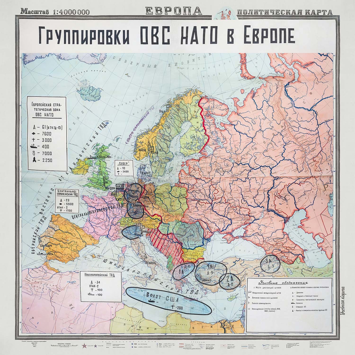
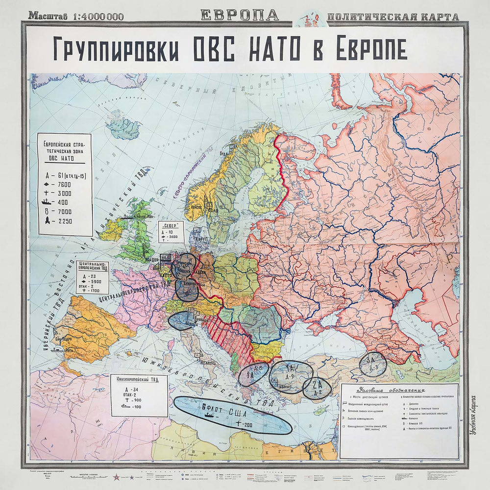
Immerse yourself in the intricate geopolitics of the Cold War with this meticulously detailed political map, "Groupings of Warsaw Pact and NATO in Europe" (Группировки ОВС НАТО в Европе). Created by the esteemed Main Directorate of Geodesy and Cartography in 1953, this map provides a fascinating glimpse into the strategic military alignments that defined Europe during one of the most tense periods in modern history. The map's comprehensive annotations and symbols offer an unparalleled view of the military installations, command centers, and combat equipment distributions of both the Warsaw Pact and NATO forces.
This historically significant map was revised by the Scientific and Editorial Cartographic Section of GUGN and signed for printing on March 26, 1953. The responsible editor, I. A. Balantseva, ensured that every detail was meticulously captured, from the number of medium and heavy tanks to the locations of tactical aviation aircraft bases and atomic bomb storage sites. The map's vivid colors and distinct lines delineate the political and military boundaries, highlighting the strategic balance of power that characterized the early years of the Cold War.
The map not only serves as a strategic military document but also as a historical artifact that reflects the intense military readiness and planning of the era. It illustrates the geopolitical landscape of Europe, with the Soviet Union and its satellite states marked in distinct colors to reflect their political and military alignment. Key NATO member states and their military installations are also prominently featured, providing a comprehensive overview of the strategic considerations that influenced international relations during this time.
Geographically, the map covers a vast region, from the United Kingdom and France in the west to the Soviet Union and its satellite states in the east. It includes significant locations such as East and West Germany, Poland, Czechoslovakia, Hungary, Romania, Bulgaria, and Albania, among others. Each of these regions is meticulously detailed, offering insights into the distribution of military forces and infrastructure that played a crucial role in the Cold War dynamics.
The design and style of the map are both functional and visually striking, using different lines and symbols to denote international borders, military command locations, and types of military equipment. This map is not just a visual representation but a historical document that provides valuable information about the strategic military considerations of the time. Owning this map is like holding a piece of history, offering a unique perspective on the geopolitical and military landscape of Europe during the Cold War.
Places on this map
- Soviet Union
- East Germany
- Poland
- Czechoslovakia
- Hungary
- Romania
- Bulgaria
- Albania
- Yugoslavia
- West Germany
- France
- Italy
- United Kingdom
- Spain
- Portugal
- Greece
- Turkey
- Norway
- Denmark
- Belgium
Notable Features & Landmarks
- Strategic military groupings of the Warsaw Pact and NATO
- Locations of combined international headquarters
- Locations of supreme headquarters
- Locations of main command centers
- Command for army groups (OTAC, OVMS, and districts)
- Number of combat equipment in groupings, including divisions
- Medium and heavy tank locations
- Tactical aviation aircraft bases
- Naval ship bases
- Atomic bomb storage sites
- Missile and aircraft carrier bases of nuclear weapons
- International borders marked with distinct lines
- Political alignment of regions marked with distinct colors
- Major cities highlighted for strategic importance
- Key NATO member states and their military installations
- Soviet Union and its satellite states marked distinctly
- Annotations indicating military installations and formations
- Symbols for different types of military establishments and forces
- Geographic regions in Europe highlighted
- Strategic balance of power during the Cold War
Historical and design context
- Created by the Main Directorate of Geodesy and Cartography (GUGN) in 1953
- Compiled by the Novosibirsk Cartographic Factory of GUGN in 1943 and revised in 1953
- Responsible editor: I. A. Balantseva
- Signed for printing on March 26, 1953
- GUGN was a Soviet government agency responsible for geodetic and cartographic activities
- Reflects the geopolitical and military landscape of Europe during the early Cold War
- Demonstrates strategic considerations of both the Warsaw Pact and NATO
- Highlights intense military readiness and planning characteristic of the period
- Provides detailed information about the distribution of military forces and infrastructure
- Uses different lines and symbols to denote international borders, military command locations, and types of military equipment
Please double check the images to make sure that a specific town or place is shown on this map. You can also get in touch and ask us to check the map for you.
This map looks great at every size, but I always recommend going for a larger size if you have space. That way you can easily make out all of the details.
This map looks amazing at sizes all the way up to 100in (250cm). If you are looking for a larger map, please get in touch.
Please note: the labels on this map are hard to read if you order a map that is 36in (90cm) or smaller. The map is still very attractive, but if you would like to read the map easily, please buy a larger size.
The model in the listing images is holding the 16x16in (40x40cm) version of this map.
The fifth listing image shows an example of my map personalisation service.
If you’re looking for something slightly different, check out my collection of the best old maps to see if something else catches your eye.
Please contact me to check if a certain location, landmark or feature is shown on this map.
This would make a wonderful birthday, Christmas, Father's Day, work leaving, anniversary or housewarming gift for someone from the areas covered by this map.
This map is available as a giclée print on acid free archival matte paper, or you can buy it framed. The frame is a nice, simple black frame that suits most aesthetics. Please get in touch if you'd like a different frame colour or material. My frames are glazed with super-clear museum-grade acrylic (perspex/acrylite), which is significantly less reflective than glass, safer, and will always arrive in perfect condition.
This map is also available as a float framed canvas, sometimes known as a shadow gap framed canvas or canvas floater. The map is printed on artist's cotton canvas and then stretched over a handmade box frame. We then "float" the canvas inside a wooden frame, which is available in a range of colours (black, dark brown, oak, antique gold and white). This is a wonderful way to present a map without glazing in front. See some examples of float framed canvas maps and explore the differences between my different finishes.
For something truly unique, this map is also available in "Unique 3D", our trademarked process that dramatically transforms the map so that it has a wonderful sense of depth. We combine the original map with detailed topography and elevation data, so that mountains and the terrain really "pop". For more info and examples of 3D maps, check my Unique 3D page.
For most orders, delivery time is about 3 working days. Personalised and customised products take longer, as I have to do the personalisation and send it to you for approval, which usually takes 1 or 2 days.
Please note that very large framed orders usually take longer to make and deliver.
If you need your order to arrive by a certain date, please contact me before you order so that we can find the best way of making sure you get your order in time.
I print and frame maps and artwork in 23 countries around the world. This means your order will be made locally, which cuts down on delivery time and ensures that it won't be damaged during delivery. You'll never pay customs or import duty, and we'll put less CO2 into the air.
All of my maps and art prints are well packaged and sent in a rugged tube if unframed, or surrounded by foam if framed.
I try to send out all orders within 1 or 2 days of receiving your order, though some products (like face masks, mugs and tote bags) can take longer to make.
If you select Express Delivery at checkout your order we will prioritise your order and send it out by 1-day courier (Fedex, DHL, UPS, Parcelforce).
Next Day delivery is also available in some countries (US, UK, Singapore, UAE) but please try to order early in the day so that we can get it sent out on time.
My standard frame is a gallery style black ash hardwood frame. It is simple and quite modern looking. My standard frame is around 20mm (0.8in) wide.
I use super-clear acrylic (perspex/acrylite) for the frame glass. It's lighter and safer than glass - and it looks better, as the reflectivity is lower.
Six standard frame colours are available for free (black, dark brown, dark grey, oak, white and antique gold). Custom framing and mounting/matting is available if you're looking for something else.
Most maps, art and illustrations are also available as a framed canvas. We use matte (not shiny) cotton canvas, stretch it over a sustainably sourced box wood frame, and then 'float' the piece within a wood frame. The end result is quite beautiful, and there's no glazing to get in the way.
All frames are provided "ready to hang", with either a string or brackets on the back. Very large frames will have heavy duty hanging plates and/or a mounting baton. If you have any questions, please get in touch.
See some examples of my framed maps and framed canvas maps.
Alternatively, I can also supply old maps and artwork on canvas, foam board, cotton rag and other materials.
If you want to frame your map or artwork yourself, please read my size guide first.
My maps are extremely high quality reproductions of original maps.
I source original, rare maps from libraries, auction houses and private collections around the world, restore them at my London workshop, and then use specialist giclée inks and printers to create beautiful maps that look even better than the original.
My maps are printed on acid-free archival matte (not glossy) paper that feels very high quality and almost like card. In technical terms the paper weight/thickness is 10mil/200gsm. It's perfect for framing.
I print with Epson ultrachrome giclée UV fade resistant pigment inks - some of the best inks you can find.
I can also make maps on canvas, cotton rag and other exotic materials.
Learn more about The Unique Maps Co.
Map personalisation
If you're looking for the perfect anniversary or housewarming gift, I can personalise your map to make it truly unique. For example, I can add a short message, or highlight an important location, or add your family's coat of arms.
The options are almost infinite. Please see my map personalisation page for some wonderful examples of what's possible.
To order a personalised map, select "personalise your map" before adding it to your basket.
Get in touch if you're looking for more complex customisations and personalisations.
Map ageing
I have been asked hundreds of times over the years by customers if they could buy a map that looks even older.
Well, now you can, by selecting Aged before you add a map to your basket.
All the product photos you see on this page show the map in its Original form. This is what the map looks like today.
If you select Aged, I will age your map by hand, using a special and unique process developed through years of studying old maps, talking to researchers to understand the chemistry of aging paper, and of course... lots of practice!
If you're unsure, stick to the Original colour of the map. If you want something a bit darker and older looking, go for Aged.
If you are not happy with your order for any reason, contact me and I'll get it fixed ASAP, free of charge. Please see my returns and refund policy for more information.
I am very confident you will like your restored map or art print. I have been doing this since 1984. I'm a 5-star Etsy seller. I have sold tens of thousands of maps and art prints and have over 5,000 real 5-star reviews. My work has been featured in interior design magazines, on the BBC, and on the walls of dozens of 5-star hotels.
I use a unique process to restore maps and artwork that is massively time consuming and labour intensive. Hunting down the original maps and illustrations can take months. I use state of the art and eye-wateringly expensive technology to scan and restore them. As a result, I guarantee my maps and art prints are a cut above the rest. I stand by my products and will always make sure you're 100% happy with what you receive.
Almost all of my maps and art prints look amazing at large sizes (200cm, 6.5ft+) and I can frame and deliver them to you as well, via special oversized courier. Contact me to discuss your specific needs.
Or try searching for something!


