


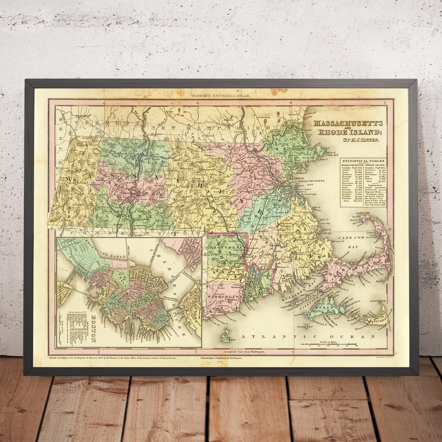
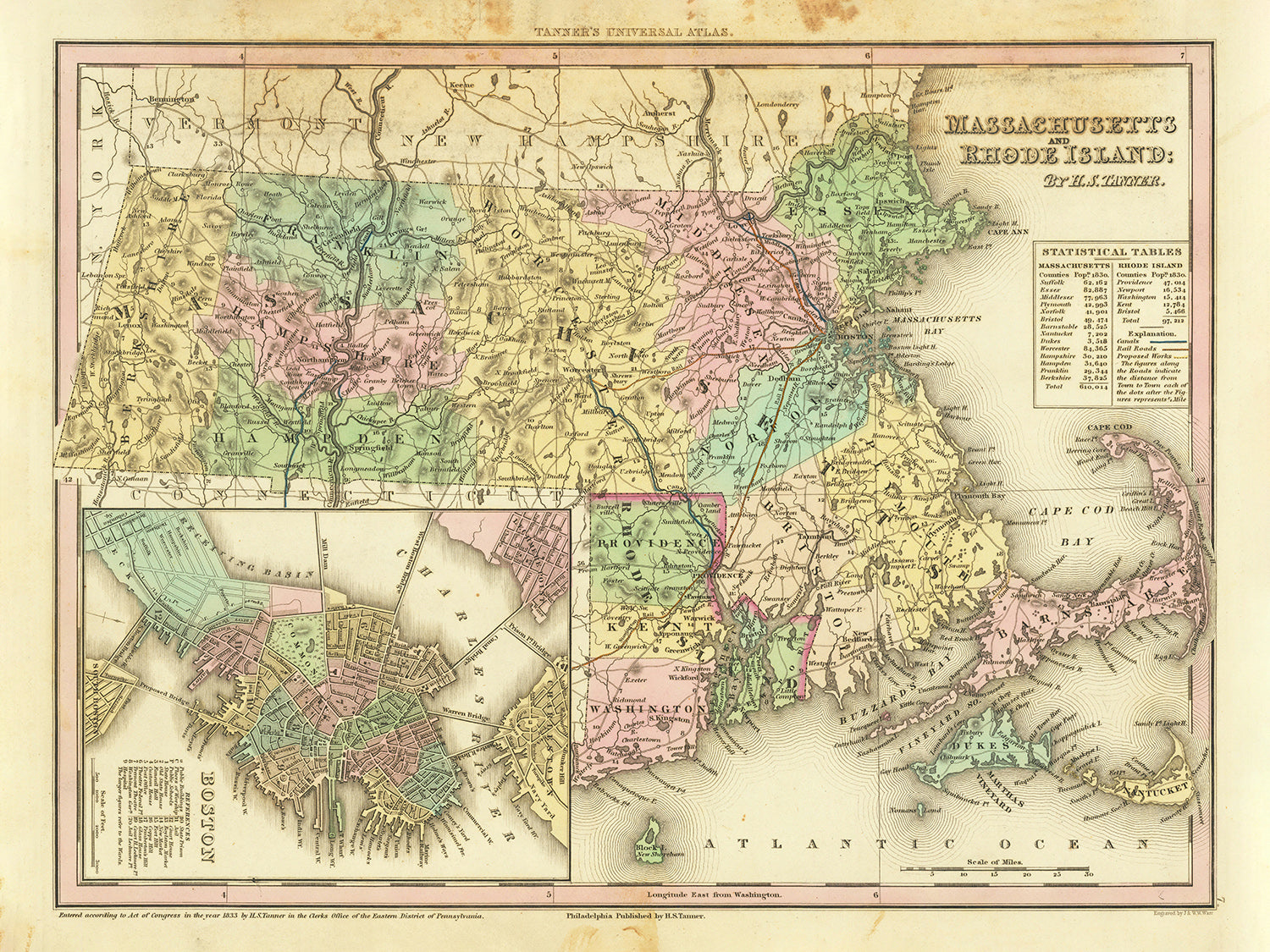


Old Map of Massachusetts and Rhode Island by H. S. Tanner, 1836: Boston, Worcester, Providence, Springfield, Cambridge
Only 1 in stock
-
Handmade in the UK
![]()
Your map will be handmade in the UK
The Unique Maps Co. is a UK-based company that prints, frames, personalises and delivers maps all around the world.
If the delivery address is in the UK, your map will be printed and framed here.
If the delivery address is outside the UK, I will print and frame the map outside of the UK. I have local production facilities in 22 countries.
This is great for gifting. For example, you can buy a map for someone in Singapore, and I'll make and deliver the map locally in Singapore with no tax or duty to be paid by the recipient.

-
Free delivery
in 2 to 3 days
Delivery in 2 to 3 days
Your map should be delivered in 2 to 3 working days with free delivery.
Express delivery is available at checkout which can reduce the delivery time to 1 to 2 days.
Please note that personalised maps, and larger framed maps, can take longer to produce and deliver.
If you need your order to arrive by a certain date, contact me and we can discuss your options.
-
Premium hardwood frames
Premium hardwood frames
My framed maps are handmade by professional, experienced framers from sustainably sourced hardwoods.
This means your framed map will feel solid and well-made.
My standard frame colours (black, dark brown, white, oak and gold) are available for all map sizes worldwide.
Custom framing is available for an additional fee.
-
Certified sustainable +
we plant trees🌳
Sustainability & Tree Planting
Here at The Unique Maps Co., we have an unusually high affinity for paper. After all, without paper, there can be no maps!
That's why all of our paper, frames and packaging are from FSC certified sources.
But we don't stop there. We've partnered with Treeapp to plant trees around the world.
If you spend £50 or more, we'll plant a tree in your name.
- 5 stars 'Excellent' rating on Trustpilot
Custom map sizes are available
At The Unique Maps Co., every order is processed and made by hand. There is no mass production and every map is custom made to order.
This means that I can tailor your map so that it perfectly fits a space on your wall, or a frame that you already own.
To order a custom sized map, select the size closest to what you need, and then select 'customise the size?' from the options below.
Custom sizing is free for large maps over 100cm or 40 inches, but for smaller maps there will be an additional small fee.
Need help ordering?
Call the workshop 9am to 5pm, or WhatsApp me any time.
Looking for a map of your city?
I can make a personalised old map of most places in the world. Contact me for more info.


Or try searching for something!
Embark on a captivating historical journey with this high-end, meticulously crafted 1836 map of Massachusetts and Rhode Island by renowned cartographer H. S. Tanner. This beautiful piece captures an era before many major modern cities even existed or when they were known by different names, offering a rare insight into the past. The map remarkably details the geography and boundaries of the region, along with charmingly accurate renderings of towns, cities, and settlements established before 1820. An attractive inset, providing a detailed view of Boston, further enhances the map’s overall allure.
With Tanner's map, you're not just owning an antiquated artifact; you're owning a tangible slice of New England's history. Its beauty lies not only in the aesthetic representation of the geographical layout but also in the intricate narratives each marked settlement carries. This unique piece of cartography allows you to navigate the progression of the region, and consequently, the evolution of American history itself.
Settlements in Massachusetts (by modern-day population size)
- Boston (1630) - Known as the Cradle of Liberty, it's the capital and largest city of Massachusetts. Key role in the American Revolution.
- Worcester (1673) - The "Heart of the Commonwealth", known for its manufacturing industry.
- Springfield (1636) - Known as the Birthplace of Basketball and location of the first American armory.
- Cambridge (1630) - Renowned for housing Harvard University, the oldest institution of higher learning in the U.S.
- Lowell (1653) - It spearheaded the American Industrial Revolution with its textile mills.
- Brockton (1649) - Known as the "City of Champions" due to its successful boxers.
- New Bedford (1640) - Once the whaling capital of the world.
- Quincy (1625) - Known as the "City of Presidents" for being the birthplace of Presidents John Adams and John Quincy Adams.
- Lynn (1629) - Noted for its shoe industry in the 19th century.
- Fall River (1656) - Known for its important role in the American cotton industry during the 19th century.
- Salem (1626) - Famous for the Salem Witch Trials of 1692.
- Somerville (1630) - Known for its diverse population and vibrant arts scene.
- Plymouth (1620) - The site of the first Pilgrim settlement, famous for Plymouth Rock.
- Medford (1630) - Famous for the creation of the popular Christmas song, "Jingle Bells".
- Gloucester (1623) - America's oldest seaport.
Settlements in Rhode Island (by modern-day population size)
- Providence (1636) - The capital of Rhode Island, known for its jewelry and silverware industry.
- Warwick (1642) - Site of the Gaspee Affair, one of the earliest acts of rebellion against British rule.
- Cranston (1642) - Noted for its textile mills in the 19th and 20th centuries.
- Pawtucket (1671) - Location of Slater Mill, the birthplace of the American Industrial Revolution.
- East Providence (1641) - Known for its diverse community and coastline along the Seekonk River.
- Woonsocket (1666) - A prominent center for the textile industry during the 19th century.
- Coventry (1639) - Known for its historic villages and mills.
- Cumberland (1747) - Home to the historic Blackstone River Valley.
- North Providence (1636) - Known for its historic farms and mills.
- West Warwick (1642) - The youngest town in Rhode Island, incorporated in 1913 from Warwick.
Notable natural and historical landmarks
- Cape Cod: A popular tourist destination known for its beaches, lighthouses, and seafood.
- Plymouth Rock: The traditional site of disembarkation of the Mayflower Pilgrims in 1620.
- Mystic River: Known for its historical seaport and maritime museum.
- Blackstone River Valley: Birthplace of America's Industrial Revolution.
- Quabbin Reservoir: One of the largest man-made public water supplies in the United States.
Historical Events (1810-1830)
- War of 1812 (1812-1815): Although largely fought on the frontiers, this war had economic and political impacts in the region.
- Industrialization: Many towns in both Massachusetts and Rhode Island began transitioning to manufacturing centers, shaping their future significantly.
- The Missouri Compromise (1820): Although this event didn't take place in the region, it had a profound impact on the political landscape of the entire country, including Massachusetts and Rhode Island.
Please double check the images to make sure that a specific town or place is shown on this map. You can also get in touch and ask us to check the map for you.
This map looks great at all sizes: 12x16in (30.5x41cm), 18x24in (45.5x61cm), 16x20in (40.5x51cm), 24x36in (61x91.5cm), 30x40in (76x101.5cm), 37x50in (94x127cm), 45x60in (114x152.5cm) and 52x70in (132x178cm), but it looks even better when printed large.
I can create beautiful, large prints of this map up to 100in (254cm). Please get in touch if you're looking for larger, customised or different framing options.
The model in the listing images is holding the 16x20in (40.5x51cm) version of this map.
The fifth listing image shows an example of my map personalisation service.
If you’re looking for something slightly different, check out my main collection of USA and North America maps.
Please contact me to check if a certain location, landmark or feature is shown on this map.
This would make a wonderful birthday, Christmas, Father's Day, work leaving, anniversary or housewarming gift for someone from the areas covered by this map.
This map is available as a giclée print on acid free archival matte paper, or you can buy it framed. The frame is a nice, simple black frame that suits most aesthetics. Please get in touch if you'd like a different frame colour or material. My frames are glazed with super-clear museum-grade acrylic (perspex/acrylite), which is significantly less reflective than glass, safer, and will always arrive in perfect condition.
My standard frame is a gallery style black ash hardwood frame. It is simple and quite modern looking. On maps up to 36 inches (91cm) the frame is 1.5-3cm (0.6in to 1in) wide. I use thicker frames on larger maps - usually between 35 and 60mm (1.4in to 2.4in).
In all cases I use super-clear acrylic (perspex/acrylite) for the frame glass. It's lighter and safer than glass - and it looks better, as the reflectivity is lower.
All frames are provided "ready to hang", with either a string or brackets on the back. Very large frames will have heavy duty hanging plates and/or a mounting baton. If you have any questions, please get in touch.
See some examples of my framed maps and framed canvas maps.
A few different frame colours are available for free (black, brown, white, oak and antique gold). Custom framing and mounting/matting is available if you're looking for something else.
Alternatively, I can also supply old maps on canvas, foam board, cotton rag and other materials.
If you want to frame your map yourself, please read my map size guide first.
For most orders, delivery time is about 3 working days. Personalised and custom made maps take longer, as I have to do the personalisation and send it to you for approval, which usually takes a day or two.
Please note that for larger framed orders (over 40in/100cm), and some other framed sizes, the delivery time will be closer to 7-10 days.
If you need your order to arrive by a certain date, please contact me before you order so that we can find the best way of making sure you get your order in time.
I have specialist printing and framing facilities in 17 countries around the world. This means your map will be made locally, which cuts down on delivery time and reduces the chance of your map being damaged during delivery. There won't be any extra taxes or duties to pay, and we'll put less CO2 into the air.
All of my maps are well packaged and sent in a rugged tube if unframed, or surrounded by foam if framed.
I try to send out all maps within 1 or 2 days of receiving your order, though some products (like face masks or mugs) can take longer to make.
If you select Express Delivery at checkout your order we will prioritise your order and send it out by 1-day courier (Fedex, DHL, UPS, Parcelforce).
We can sometimes do next-day delivery if you order before 10am. But usually it's best to contact me first before you order.
My maps are extremely high quality reproductions of original maps.
I source original, extremely rare maps from libraries, auction houses and private collections around the world, restore them at my London workshop, and then use specialist giclée inks and printers to create beautiful maps that look even better than the original.
My maps are printed on acid-free archival matte (not glossy) paper that feels very high quality and almost like card. In technical terms the paper weight/thickness is 10mil/200gsm. It's perfect for framing.
I print with Epson ultrachrome giclée UV fade resistant pigment inks - some of the best inks you can find.
I can also make maps on canvas, cotton rag and other exotic materials.
Learn more about how the Unique Maps Co. sources and restores old maps
Map personalisation
If you're looking for the perfect anniversary or housewarming gift, I can personalise your map to make it truly unique. For example, I can add a short message, or highlight an important location, or add your family's coat of arms.
The options are almost infinite. Please see my map personalisation page for some wonderful examples of what's possible.
To order a personalised map, select "personalise your map" before adding it to your basket.
Get in touch if you're looking for more complex customisations and personalisations.
If you are not happy with your unique map for any reason, contact me for a no-quibble refund.
I am very confident you will like your old map. I have been doing this since 1984. I'm a 5-star Etsy seller. I have sold tens of thousands of maps and have over 1,500 real 5-star reviews.
I use a unique process to restore my maps that is massively time consuming and labour intensive. Hunting down the original maps can take months. I use state of the art and eye-wateringly expensive technology to scan and restore the maps. As a result, I guarantee my maps are a cut above the rest - that's why I can offer a no-quibble refund.
Almost all of my maps look amazing at large sizes (200cm, 6.5ft+) and I can frame and deliver them to you as well, via special oversized courier. Contact me to discuss your specific needs.


