


Vecchia mappa dello Shropshire di Samuel Lewis, 1844: Telford, Shrewsbury, Oswestry, Bridgnorth e Wellington
Spend £250, Save £50 Christmas Express Delivery available at checkout
Spend £250, Save £50

-
![]() Handmade in the UK (we're based in London)
Handmade in the UK (we're based in London)
-
FREE delivery in 3-4 days ⓘ
Free delivery in 3-4 days
Your map should be delivered in 3-4 working days with free delivery, worldwide.
Please use Express Delivery at checkout for Christmas orders. Framed orders may arrive with Express Delivery, but it is not guaranteed.
New for 2025: After you order, you can send a beautiful gift preview by email, if you're worried it won't arrive on time.
We make maps by hand locally in 23 countries. If you're buying a gift for someone in another country, we will make the map locally to them.
You will never pay import tax or customs duty.
Check the Christmas delivery guide for order deadlines. Delivery times are starting to slow down, and will continue to slow down towards Christmas.
Express delivery is available at checkout which can reduce the delivery time to 1-2 days.
Please note that personalised maps, and larger framed maps, can take longer to produce and deliver.
If you need your order to arrive by a certain date, contact me and we can discuss your options.
-
FREE gift preview
ⓘ
Digital gift preview
New for 2025: After you complete your order, you can send a beautiful digital preview to the gift recipient. Just provide their email address and we'll do the rest. (Their email address will not be stored or used for any other purpose.)
This is perfect for Christmas gifting, particularly if you're concerned that your order might not arrive in time for Christmas.
-
90 day money back guarantee
ⓘ
90 giorni per restituire e ricevere un rimborso
I prodotti possono essere restituiti entro 90 giorni per un rimborso completo, o cambio con un altro prodotto.
Per articoli personalizzati e su misura, potremmo offrirti un credito in negozio o una carta regalo non scadente, poiché non possiamo rivendere ordini personalizzati.
Se hai domande, contattaci. Per ulteriori informazioni, consulta la nostra politica di restituzione e cambio.

My maps are rare, museum-grade, restored old maps sourced from libraries, auction houses and private collections across the globe.
Framing & free personalisation available
1. Select your size
2. Frame & personalise your map
There is limited framing & personalisation capacity available. Order by 10am tomorrow for Christmas delivery.


Gift message & custom finish

If you want to add a gift message, or a finish (jigsaw, aluminium board, etc.) that is not available here, please request it in the "order note" when you check out.
Every order is custom made, so if you need the size adjusted slightly, or printed on an unusual material, just let us know. We've done thousands of custom orders over the years, so there's (almost) nothing we can't manage.
You can also contact us before you order, if you prefer!

- Handmade locally. No import duty or tax
- FREE Delivery by Christmas
- Love it or your money back (90 days)
- Questions? WhatsApp me any time
Own a piece of history
5,000+ 5 star reviews


Immergiti nella grandezza del passato dello Shropshire con questa splendida mappa del 1844 di Samuel Lewis. Celebra la ricca storia di una delle contee più pittoresche dell'Inghilterra, attentamente tracciata su una tela che cattura l'essenza dell'epoca. Questa mappa, accuratamente conservata, non solo incarna la precisione e il dettaglio della cartografia del XIX secolo, ma offre anche un'affascinante visione del paesaggio in evoluzione di una contea che è stata il palcoscenico di una trama di eventi storici.
Sarai affascinato da questo gioiello storico, che mostra la rete di insediamenti che si sono successivamente sviluppati in alcune delle città vivaci di oggi. Telford, una città moderna che non appare su questa mappa, è curiosamente venuta in esistenza più tardi nel XX secolo. Altre città come Dawley e Wellington, sono viste con i loro vecchi nomi, prima di amalgamarsi in Telford. Per gli appassionati di storia e cartografia, questa è un'opportunità per connettersi con il passato, vedendo come sono stati seminati i semi del moderno Shropshire.
Elenco degli Insediamenti:
- Telford (1968): Questa città non esisteva al momento in cui la mappa è stata realizzata. Telford è una città moderna che è venuta in esistenza nel XX secolo. È ora conosciuta per i suoi moderni centri commerciali e per il storico Ironbridge Gorge.
- Shrewsbury (800): La città capoluogo dello Shropshire, Shrewsbury era un luogo significativo nella Inghilterra medievale. Presenta un piano stradale medievale in gran parte intatto e oltre 660 edifici elencati, tra cui diversi esempi di legno intagliato dal XV e XVI secolo.
- Oswestry (1190): Nota per la sua posizione strategica al confine tra Galles e Inghilterra, ha un mix di culture. Ha una ricca storia di conflitti a causa della sua posizione di confine.
- Bridgnorth (895): Fondata da Alfredo il Grande come un forte difensivo contro i danesi, Bridgnorth si trova in alto su una scogliera sopra il fiume Severn. La città è divisa in High Town e Low Town, nominate in base alle loro altitudini rispetto al fiume Severn, che separa le parti superiori e inferiori della città.
- Wellington (1244): Questa città di mercato è diventata parte dell'attuale Telford. L'Old Hall, un edificio del XIV secolo, è uno dei suoi siti storici notevoli.
- Ludlow (1085): Nota per il suo castello e la sua vecchia piazza del mercato. La città ha quasi 500 edifici elencati, tra cui esempi del XIII secolo.
- Newport (963): Questa città di mercato è una delle città medievali meglio conservate nello Shropshire.
- Market Drayton (1245): La città è rinomata per i suoi biscotti allo zenzero, che vengono cotti qui da oltre 200 anni.
- Whitchurch (70 d.C.): Nota come Mediolanum in epoca romana, è una delle città più antiche continuamente abitate del paese.
- Shifnal (728): Originariamente una città di mercato, Shifnal ha molti edifici storici, tra cui Shifnal Manor House, Park House e la Chiesa di Sant'Andrea.
- Broseley (XVI secolo): Nota per i suoi depositi di ferro, la città ha svolto un ruolo essenziale nella Rivoluzione Industriale.
- Bayston Hill (preistoria): Un grande villaggio a sud di Shrewsbury, Bayston Hill è stato abitato sin dai tempi preistorici.
- Albrighton (XI secolo): Nota per la sua foresta di caccia che era utilizzata dalla regalità nel Medioevo.
- Church Stretton (60 d.C.): Immersa tra le colline del Sud Shropshire designate come Area di Eccezionale Bellezza Naturale (AONB), fu fondata dai romani come città di mercato.
- Wem (1202) : Conosciuta per le sue industrie di birrificazione, tessitura e produzione di cesti in passato.
- Ellesmere (1114): Conosciuta per la sua posizione panoramica vicino al lago 'The Mere', uno dei più grandi laghi naturali in Inghilterra.
- Craven Arms (1800s): Prende il nome dal pub Craven Arms, questa città ospita il Castello di Stokesay, una delle case padronali fortificate meglio conservate in Inghilterra.
- Pontesbury (1227): Conosciuta per la sua storica Chiesa di San Giorgio e il Colle di Pontesford.
- Much Wenlock (680): Famosa come il luogo di nascita del Dr. William Penny Brookes, l'ispirazione per i moderni Giochi Olimpici.
- Cleobury Mortimer (1086): La città ospita il campanile storto della Chiesa di Santa Maria.
- Bishop's Castle (1249): Conosciuta per le sue birrerie tradizionali, ospita anche un festival annuale della birra artigianale.
- Madeley (pre-8° secolo): Questa città ospita il storico Madeley Court, costruito nel XVI secolo.
- Highley (1086): Il villaggio è noto per la Severn Valley Railway.
- Ironbridge (18° secolo): Prende il nome dal Ponte di Ferro, è spesso considerato il luogo di nascita della Rivoluzione Industriale.
- Shawbury (preistoria): Questo villaggio è stato abitato fin dai tempi preistorici ed è ora noto per la sua stazione della Royal Air Force.
- Gobowen (1840): Conosciuta per la sua stazione ferroviaria, una delle più antiche nello Shropshire.
- Prees (preistoria): Conosciuta per il suo Whixall Moss, un Sito di Interesse Scientifico Speciale.
- Clun (1138): Conosciuta per il Castello di Clun, un edificio classificato di Grado I.
- Westbury (1086): Il villaggio ospita la Chiesa di Santa Maria, classificata di Grado II*.
- Rodington (1086): Conosciuta per Longdon-on-Tern, che ospita il primo acquedotto navigabile in ghisa su larga scala del mondo.
Caratteristiche notevoli:
- Il fiume Severn, il fiume più lungo del Regno Unito, scorre attraverso lo Shropshire, aggiungendo bellezza panoramica alla regione.
- La gola di Ironbridge, un Sito Patrimonio dell'Umanità dell'UNESCO, è un simbolo iconico della Rivoluzione Industriale.
- Le colline dello Shropshire, un'Area di Eccezionale Bellezza Naturale, offrono uno sfondo sereno e pittoresco.
- Monumenti storici come il Castello di Ludlow, il Castello di Stokesay e l'Abbazia di Shrewsbury offrono scorci sulla ricca storia medievale della contea.
- Le antiche città di mercato dello Shropshire come Ludlow, Oswestry e Market Drayton mostrano un fascino senza tempo.
In conclusione, la mappa di Shropshire di Samuel Lewis del 1844 funge da finestra su un intrigante paesaggio storico, segnato da antichi insediamenti, monumenti storici e un passato intrecciato con la storia della Rivoluzione Industriale.
Si prega di controllare le immagini per assicurarsi che una città o un luogo specifico sia mostrato su questa mappa. È possibile anche contattarci e chiedere di controllare la mappa per voi.
Questa mappa appare fantastica in tutte le dimensioni: 8x10in (20.5x25.5cm), 12x16in (30.5x41cm), 18x24in (45.5x61cm), 16x20in (40.5x51cm), 24x36in (61x91.5cm), 30x40in (76x101.5cm) e 37x50in (94x127cm), ma appare ancora meglio quando stampata in grande.
Posso creare bellissime stampe grandi di questa mappa fino a 50in (127cm). Si prega di contattarmi se si cercano opzioni di incorniciatura più grandi, personalizzate o diverse.
Il modello nelle immagini dell'elenco tiene la versione 18x24in (45.5x61cm) di questa mappa.
La quinta immagine dell'elenco mostra un esempio del mio servizio di personalizzazione della mappa.
Se stai cercando qualcosa di leggermente diverso, dai un'occhiata alla mia principale collezione di mappe del Regno Unito e dell'Irlanda.
Per favore contattami per verificare se una certa posizione, un punto di riferimento o una caratteristica è mostrata su questa mappa.
Questa sarebbe un'ottima idea regalo per un compleanno, Natale, Festa del Papà, un congedo dal lavoro, un anniversario o una festa di inaugurazione per qualcuno delle aree coperte da questa mappa.
Questa mappa è disponibile come stampa giclée su carta opaca archiviata senza acidi, oppure puoi acquistarla incorniciata. La cornice è una semplice cornice nera che si adatta alla maggior parte degli stili. Per favore, contattami se desideri un colore o un materiale della cornice diverso. Le mie cornici sono dotate di un vetro acrilico (perspex/acrylite) super chiaro di grado museale, che è significativamente meno riflettente del vetro, più sicuro e arriverà sempre in condizioni perfette.
This map is also available as a float framed canvas, sometimes known as a shadow gap framed canvas or canvas floater. The map is printed on artist's cotton canvas and then stretched over a handmade box frame. We then "float" the canvas inside a wooden frame, which is available in a range of colours (black, dark brown, oak, antique gold and white). This is a wonderful way to present a map without glazing in front. See some examples of float framed canvas maps and explore the differences between my different finishes.
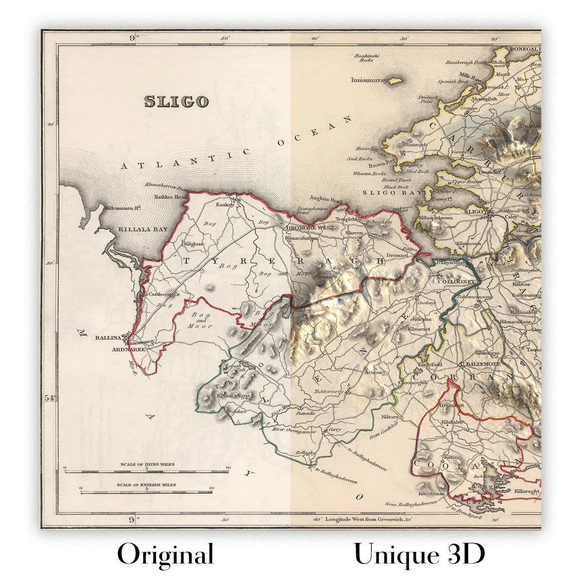
For something truly unique, this map is also available in "Unique 3D", our trademarked process that dramatically transforms the map so that it has a wonderful sense of depth. We combine the original map with detailed topography and elevation data, so that mountains and the terrain really "pop". For more info and examples of 3D maps, check my Unique 3D page.
For most orders, delivery time is about 3 working days. Personalised and customised products take longer, as I have to do the personalisation and send it to you for approval, which usually takes 1 or 2 days.
Please note that very large framed orders usually take longer to make and deliver.
If you need your order to arrive by a certain date, please contact me before you order so that we can find the best way of making sure you get your order in time.
I print and frame maps and artwork in 23 countries around the world. This means your order will be made locally, which cuts down on delivery time and ensures that it won't be damaged during delivery. You'll never pay customs or import duty, and we'll put less CO2 into the air.
All of my maps and art prints are well packaged and sent in a rugged tube if unframed, or surrounded by foam if framed.
I try to send out all orders within 1 or 2 days of receiving your order, though some products (like face masks, mugs and tote bags) can take longer to make.
If you select Express Delivery at checkout your order we will prioritise your order and send it out by 1-day courier (Fedex, DHL, UPS, Parcelforce).
Next Day delivery is also available in some countries (US, UK, Singapore, UAE) but please try to order early in the day so that we can get it sent out on time.
My standard frame is a gallery style black ash hardwood frame. It is simple and quite modern looking. My standard frame is around 20mm (0.8in) wide.
I use super-clear acrylic (perspex/acrylite) for the frame glass. It's lighter and safer than glass - and it looks better, as the reflectivity is lower.
Six standard frame colours are available for free (black, dark brown, dark grey, oak, white and antique gold). Custom framing and mounting/matting is available if you're looking for something else.
Most maps, art and illustrations are also available as a framed canvas. We use matte (not shiny) cotton canvas, stretch it over a sustainably sourced box wood frame, and then 'float' the piece within a wood frame. The end result is quite beautiful, and there's no glazing to get in the way.
All frames are provided "ready to hang", with either a string or brackets on the back. Very large frames will have heavy duty hanging plates and/or a mounting baton. If you have any questions, please get in touch.
See some examples of my framed maps and framed canvas maps.
Alternatively, I can also supply old maps and artwork on canvas, foam board, cotton rag and other materials.
If you want to frame your map or artwork yourself, please read my size guide first.
Alcune delle mie vecchie mappe sono ora disponibili come tele incorniciate. Per favore contattami se desideri ordinare una dimensione che non è disponibile nel mio negozio.
Le vecchie mappe su tela sono un'alternativa interessante alle mappe incorniciate in modo convenzionale. A seconda del tuo gusto personale e dell'arredamento della stanza, le mappe su tela possono "risaltare" un po' di più rispetto a una mappa incorniciata.
My maps are extremely high quality reproductions of original maps.
I source original, rare maps from libraries, auction houses and private collections around the world, restore them at my London workshop, and then use specialist giclée inks and printers to create beautiful maps that look even better than the original.
My maps are printed on acid-free archival matte (not glossy) paper that feels very high quality and almost like card. In technical terms the paper weight/thickness is 10mil/200gsm. It's perfect for framing.
I print with Epson ultrachrome giclée UV fade resistant pigment inks - some of the best inks you can find.
I can also make maps on canvas, cotton rag and other exotic materials.
Learn more about The Unique Maps Co.
Map personalisation
If you're looking for the perfect anniversary or housewarming gift, I can personalise your map to make it truly unique. For example, I can add a short message, or highlight an important location, or add your family's coat of arms.
The options are almost infinite. Please see my map personalisation page for some wonderful examples of what's possible.
To order a personalised map, select "personalise your map" before adding it to your basket.
Get in touch if you're looking for more complex customisations and personalisations.
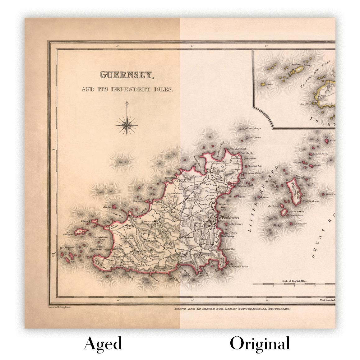
Map ageing
I have been asked hundreds of times over the years by customers if they could buy a map that looks even older.
Well, now you can, by selecting Aged before you add a map to your basket.
All the product photos you see on this page show the map in its Original form. This is what the map looks like today.
If you select Aged, I will age your map by hand, using a special and unique process developed through years of studying old maps, talking to researchers to understand the chemistry of aging paper, and of course... lots of practice!
If you're unsure, stick to the Original colour of the map. If you want something a bit darker and older looking, go for Aged.
Se non sei soddisfatto del tuo ordine per qualsiasi motivo, contattami per un rimborso senza problemi. Si prega di consultare la nostra politica di reso e rimborso per ulteriori informazioni.
Sono molto sicuro che ti piacerà la tua mappa restaurata o la stampa d'arte. Lo faccio dal 1984. Sono un venditore Etsy a 5 stelle. Ho venduto decine di migliaia di mappe e stampe d'arte e ho oltre 5.000 recensioni reali a 5 stelle.
Utilizzo un processo unico per restaurare mappe e opere d'arte che richiede molto tempo e lavoro. Trovare le mappe e le illustrazioni originali può richiedere mesi. Utilizzo tecnologia all'avanguardia e incredibilmente costosa per scannerizzare e restaurarle. Di conseguenza, garantisco che le mie mappe e stampe d'arte siano superiori alle altre - ecco perché posso offrire un rimborso senza problemi.
Quasi tutte le mie mappe e stampe d'arte sembrano fantastiche a grandi dimensioni (200 cm, 6,5 piedi+) e posso anche incorniciarle e consegnarle a te, tramite un corriere speciale per oggetti di grandi dimensioni. Contattami per discutere delle tue esigenze specifiche.
Or try searching for something!


