


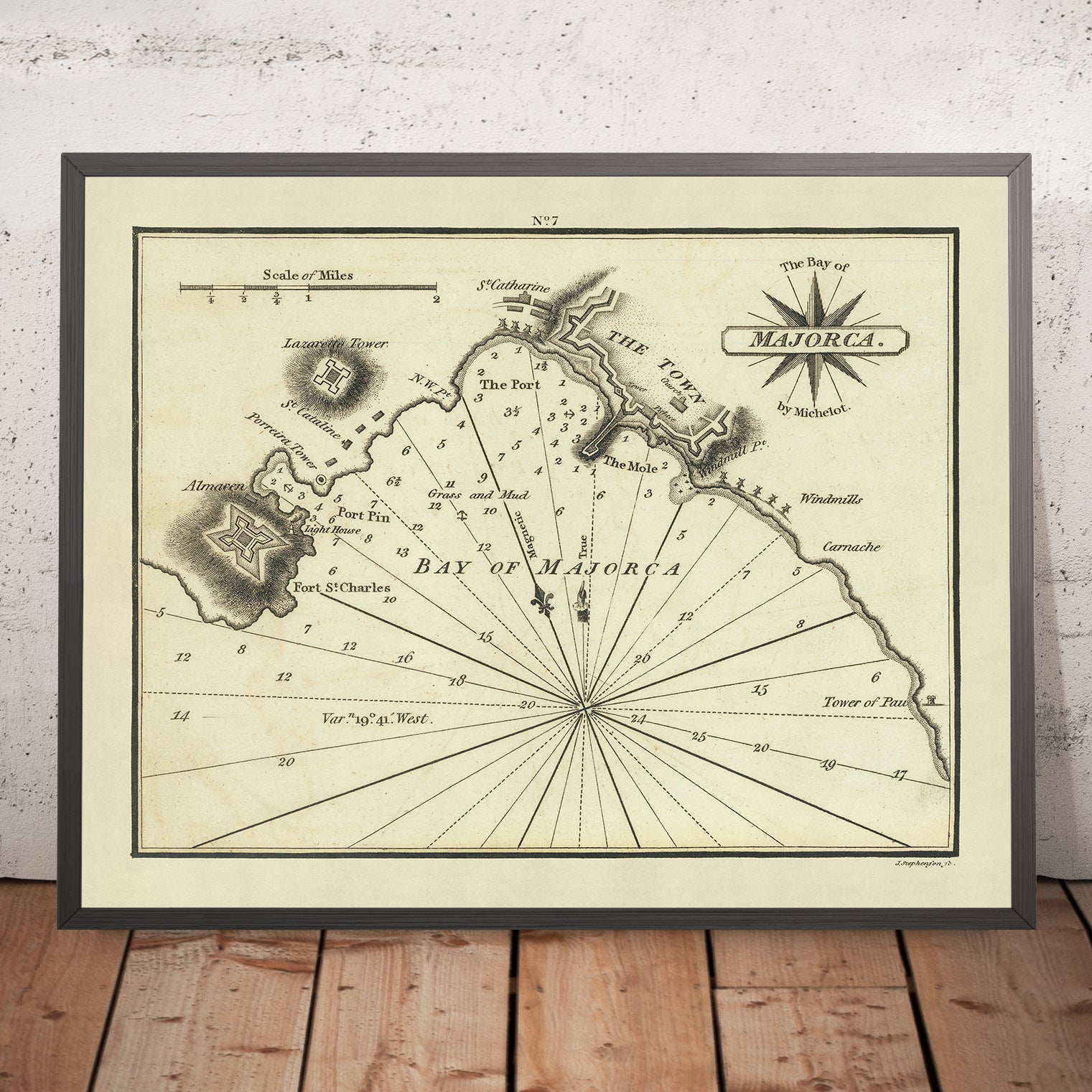
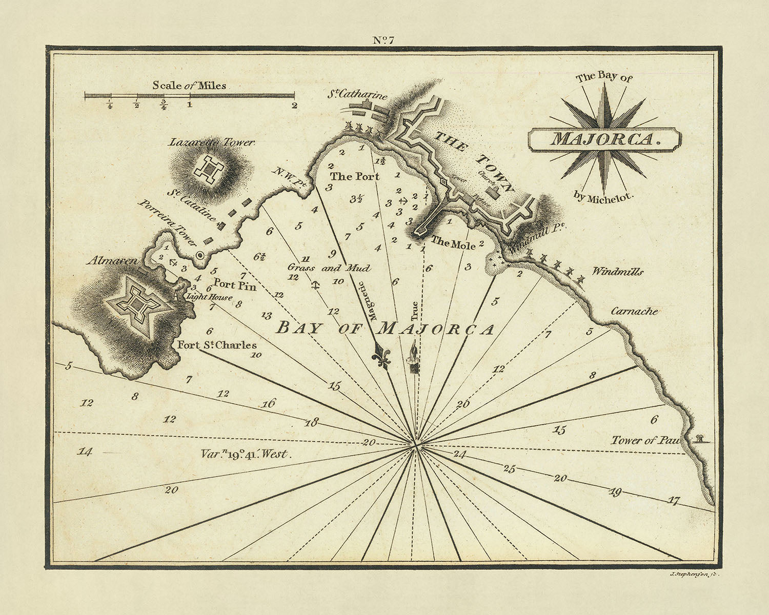


Old Bay of Majorca Nautical Chart by Heather, 1802: Lazarette Tower, Porreira Tower, Almacen
Only 1 in stock
-
Handmade in the UK
![]()
Your map will be handmade in the UK
The Unique Maps Co. is a UK-based company that prints, frames, personalises and delivers maps all around the world.
If the delivery address is in the UK, your map will be printed and framed here.
If the delivery address is outside the UK, I will print and frame the map outside of the UK. I have local production facilities in 22 countries.
This is great for gifting. For example, you can buy a map for someone in Singapore, and I'll make and deliver the map locally in Singapore with no tax or duty to be paid by the recipient.

-
Free delivery
in 2 to 3 days
Delivery in 2 to 3 days
Your map should be delivered in 2 to 3 working days with free delivery.
Express delivery is available at checkout which can reduce the delivery time to 1 to 2 days.
Please note that personalised maps, and larger framed maps, can take longer to produce and deliver.
If you need your order to arrive by a certain date, contact me and we can discuss your options.
-
Premium hardwood frames
Premium hardwood frames
My framed maps are handmade by professional, experienced framers from sustainably sourced hardwoods.
This means your framed map will feel solid and well-made.
My standard frame colours (black, dark brown, white, oak and gold) are available for all map sizes worldwide.
Custom framing is available for an additional fee.
-
Certified sustainable +
we plant trees🌳
Sustainability & Tree Planting
Here at The Unique Maps Co., we have an unusually high affinity for paper. After all, without paper, there can be no maps!
That's why all of our paper, frames and packaging are from FSC certified sources.
But we don't stop there. We've partnered with Treeapp to plant trees around the world.
If you spend £50 or more, we'll plant a tree in your name.
- 5 stars 'Excellent' rating on Trustpilot
Custom map sizes are available
At The Unique Maps Co., every order is processed and made by hand. There is no mass production and every map is custom made to order.
This means that I can tailor your map so that it perfectly fits a space on your wall, or a frame that you already own.
To order a custom sized map, select the size closest to what you need, and then select 'customise the size?' from the options below.
Custom sizing is free for large maps over 100cm or 40 inches, but for smaller maps there will be an additional small fee.


Or try searching for something!
Immerse yourself in the rich maritime history of the Mediterranean with "The Bay of Majorca," a meticulously detailed nautical chart crafted by the esteemed English cartographer William Heather in 1802. This chart is not merely a navigational aid but a piece of art, showcasing Heather's dedication to enhancing English nautical cartography. The chart features the intricate coastline of Majorca, an island celebrated for its breathtaking landscapes and strategic maritime significance. Heather's work is part of his pioneering endeavor, "The New Mediterranean Pilot," marking the first English compilation of Mediterranean ports, a bold challenge to the earlier French, Italian, and Spanish dominions in maritime mapping.
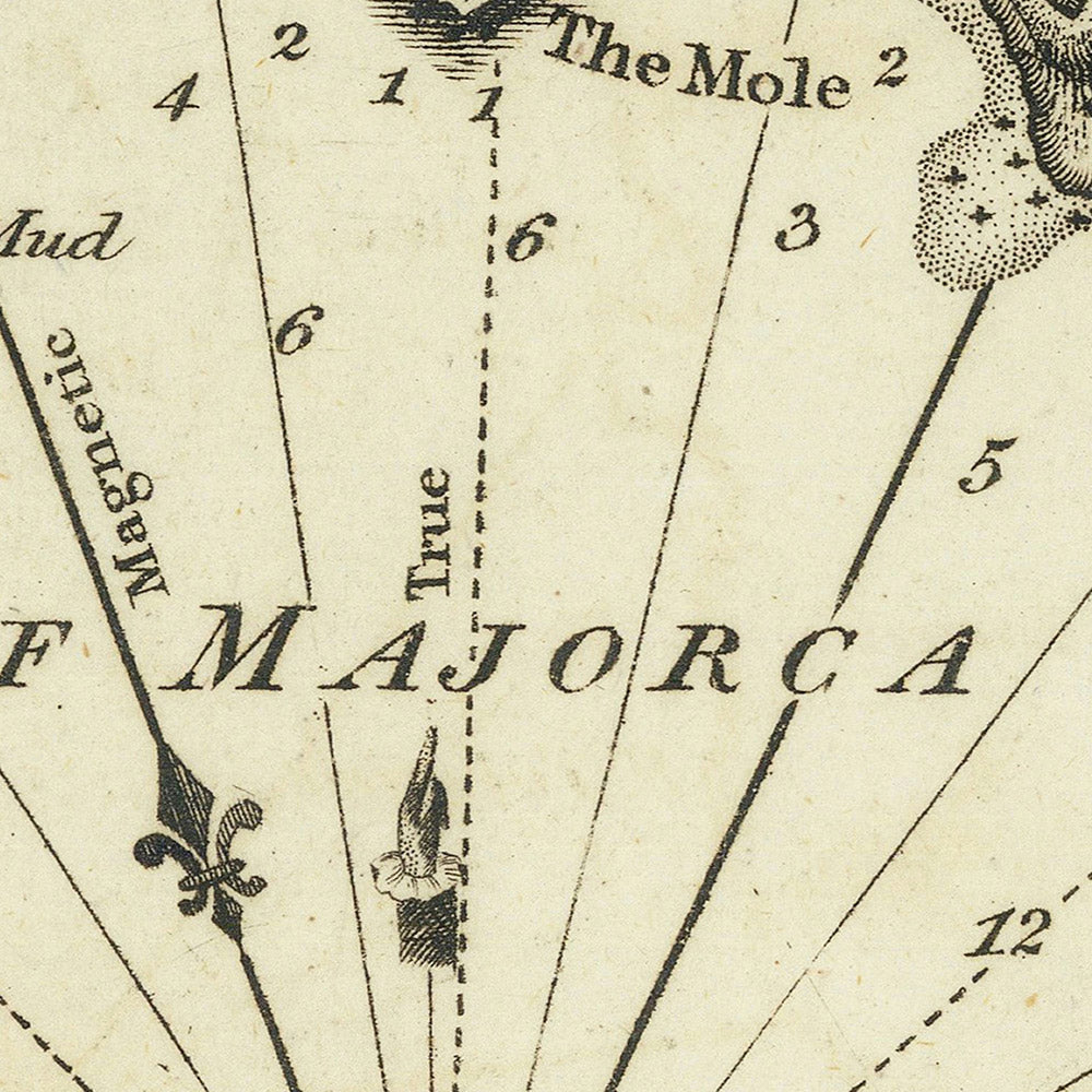
This chart is particularly valuable for its depiction of key maritime and topographical features. It details soundings, anchorages, and navigational aids like compass roses and scale bars, essential for sailors navigating these waters in the early 19th century. The inclusion of pictorial representations of towns and fortresses, notably around Palma, the vibrant capital of Majorca, adds a layer of visual depth and historical context, making it a fascinating snapshot of the period's geographic and military details.
Prominent landmarks such as Lazarette Tower, Porreira Tower, Almacen, and St. Catharine are elegantly engraved, highlighting Heather's attention to detail and his commitment to accuracy and utility in his charts. These features not only served as crucial navigational aids but also as points of interest that tell tales of the island's past, from its role in maritime trade to its architectural heritage.
The rarity of this chart adds immensely to its allure and collectible value. As a part of Heather's ambitious "The New Mediterranean Pilot," this chart represents a significant moment in cartographic history. It stands out for its fine engraving, a testament to the high-quality craftsmanship of London engraver John Stephenson, whose work helped set a new standard in the clarity and precision of maritime charts.
Owning "The Bay of Majorca" chart is not just about possessing a rare piece of history; it's about connecting to a time when maritime exploration and cartography were pivotal to the expansion and understanding of the world. This chart is an invitation to explore not just the physical landscape of Majorca but also the evolution of map-making and its impact on navigation and trade in the Mediterranean. For collectors and enthusiasts of cartography, maritime history, or simply the enchanting island of Majorca, this chart is a prized acquisition that embodies the spirit of exploration and the enduring allure of the sea.
Notable places on this map
- The coastline of Majorca, including bays and headlands
- Several towns and cities, including Palma, the capital of Majorca
Notable Features & Landmarks
- Lazarette Tower
- Porreira Tower
- Almacen
- St. Catharine
- Soundings, topographical features, and anchorages
- Pictorial representation of the town and fortress
Historical and Design Context
- Created by William Heather in 1802
- Part of "Heather's The New Mediterranean Pilot," the first English attempt at a collection of ports of the Mediterranean
- Finely engraved chart, notable for its detail and clarity
- Represents a significant moment in cartographic history, showcasing early English contributions to Mediterranean maritime charts
Please double check the images to make sure that a specific town or place is shown on this map. You can also get in touch and ask us to check the map for you.
This map looks great at every size, but I always recommend going for a larger size if you have space. That way you can easily make out all of the details.
This map looks amazing at sizes all the way up to 50in (125cm). If you are looking for a larger map, please get in touch.
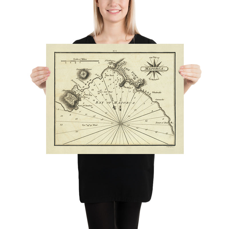
The model in the listing images is holding the 16x20in (40x50cm) version of this map.
The fifth listing image shows an example of my map personalisation service.
If you’re looking for something slightly different, check out my collection of the best old maps to see if something else catches your eye.
Please contact me to check if a certain location, landmark or feature is shown on this map.
This would make a wonderful birthday, Christmas, Father's Day, work leaving, anniversary or housewarming gift for someone from the areas covered by this map.
This map is available as a giclée print on acid free archival matte paper, or you can buy it framed. The frame is a nice, simple black frame that suits most aesthetics. Please get in touch if you'd like a different frame colour or material. My frames are glazed with super-clear museum-grade acrylic (perspex/acrylite), which is significantly less reflective than glass, safer, and will always arrive in perfect condition.
My standard frame is a gallery style black ash hardwood frame. It is simple and quite modern looking. On maps up to 36 inches (91cm) the frame is 1.5-3cm (0.6in to 1in) wide. I use thicker frames on larger maps - usually between 35 and 60mm (1.4in to 2.4in).
In all cases I use super-clear acrylic (perspex/acrylite) for the frame glass. It's lighter and safer than glass - and it looks better, as the reflectivity is lower.
All frames are provided "ready to hang", with either a string or brackets on the back. Very large frames will have heavy duty hanging plates and/or a mounting baton. If you have any questions, please get in touch.
See some examples of my framed maps and framed canvas maps.
A few different frame colours are available for free (black, brown, white, oak and antique gold). Custom framing and mounting/matting is available if you're looking for something else.
Alternatively, I can also supply old maps on canvas, foam board, cotton rag and other materials.
If you want to frame your map yourself, please read my map size guide first.
For most orders, delivery time is about 3 working days. Personalised and custom made maps take longer, as I have to do the personalisation and send it to you for approval, which usually takes a day or two.
Please note that for larger framed orders (over 40in/100cm), and some other framed sizes, the delivery time will be closer to 7-10 days.
If you need your order to arrive by a certain date, please contact me before you order so that we can find the best way of making sure you get your order in time.
I have specialist printing and framing facilities in 17 countries around the world. This means your map will be made locally, which cuts down on delivery time and reduces the chance of your map being damaged during delivery. There won't be any extra taxes or duties to pay, and we'll put less CO2 into the air.
All of my maps are well packaged and sent in a rugged tube if unframed, or surrounded by foam if framed.
I try to send out all maps within 1 or 2 days of receiving your order, though some products (like face masks or mugs) can take longer to make.
If you select Express Delivery at checkout your order we will prioritise your order and send it out by 1-day courier (Fedex, DHL, UPS, Parcelforce).
We can sometimes do next-day delivery if you order before 10am. But usually it's best to contact me first before you order.
My maps are extremely high quality reproductions of original maps.
I source original, extremely rare maps from libraries, auction houses and private collections around the world, restore them at my London workshop, and then use specialist giclée inks and printers to create beautiful maps that look even better than the original.
My maps are printed on acid-free archival matte (not glossy) paper that feels very high quality and almost like card. In technical terms the paper weight/thickness is 10mil/200gsm. It's perfect for framing.
I print with Epson ultrachrome giclée UV fade resistant pigment inks - some of the best inks you can find.
I can also make maps on canvas, cotton rag and other exotic materials.
Learn more about how the Unique Maps Co. sources and restores old maps
Map personalisation
If you're looking for the perfect anniversary or housewarming gift, I can personalise your map to make it truly unique. For example, I can add a short message, or highlight an important location, or add your family's coat of arms.
The options are almost infinite. Please see my map personalisation page for some wonderful examples of what's possible.
To order a personalised map, select "personalise your map" before adding it to your basket.
Get in touch if you're looking for more complex customisations and personalisations.
If you are not happy with your unique map for any reason, contact me for a no-quibble refund.
I am very confident you will like your old map. I have been doing this since 1984. I'm a 5-star Etsy seller. I have sold tens of thousands of maps and have over 1,500 real 5-star reviews.
I use a unique process to restore my maps that is massively time consuming and labour intensive. Hunting down the original maps can take months. I use state of the art and eye-wateringly expensive technology to scan and restore the maps. As a result, I guarantee my maps are a cut above the rest - that's why I can offer a no-quibble refund.
Almost all of my maps look amazing at large sizes (200cm, 6.5ft+) and I can frame and deliver them to you as well, via special oversized courier. Contact me to discuss your specific needs.


